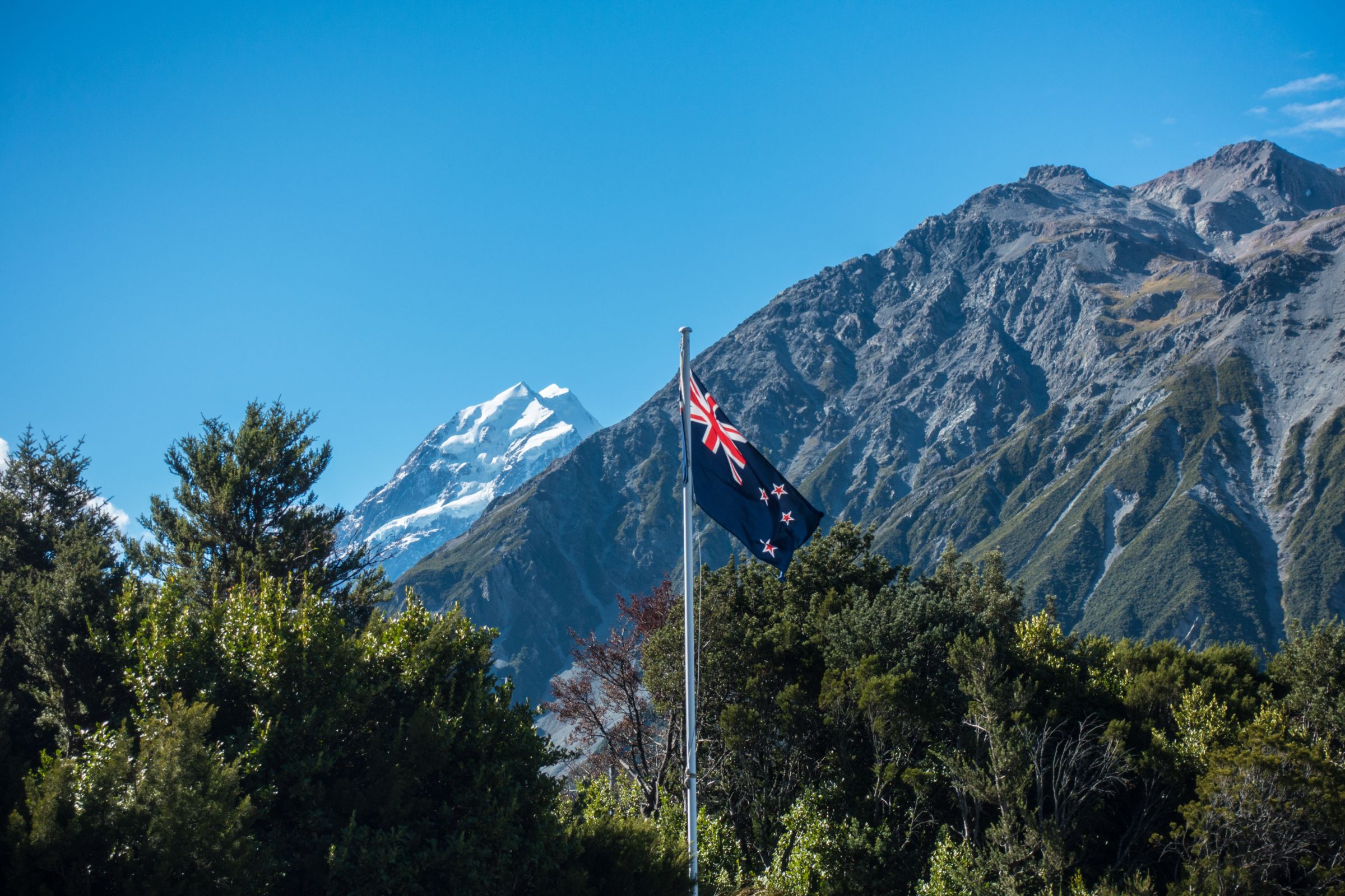
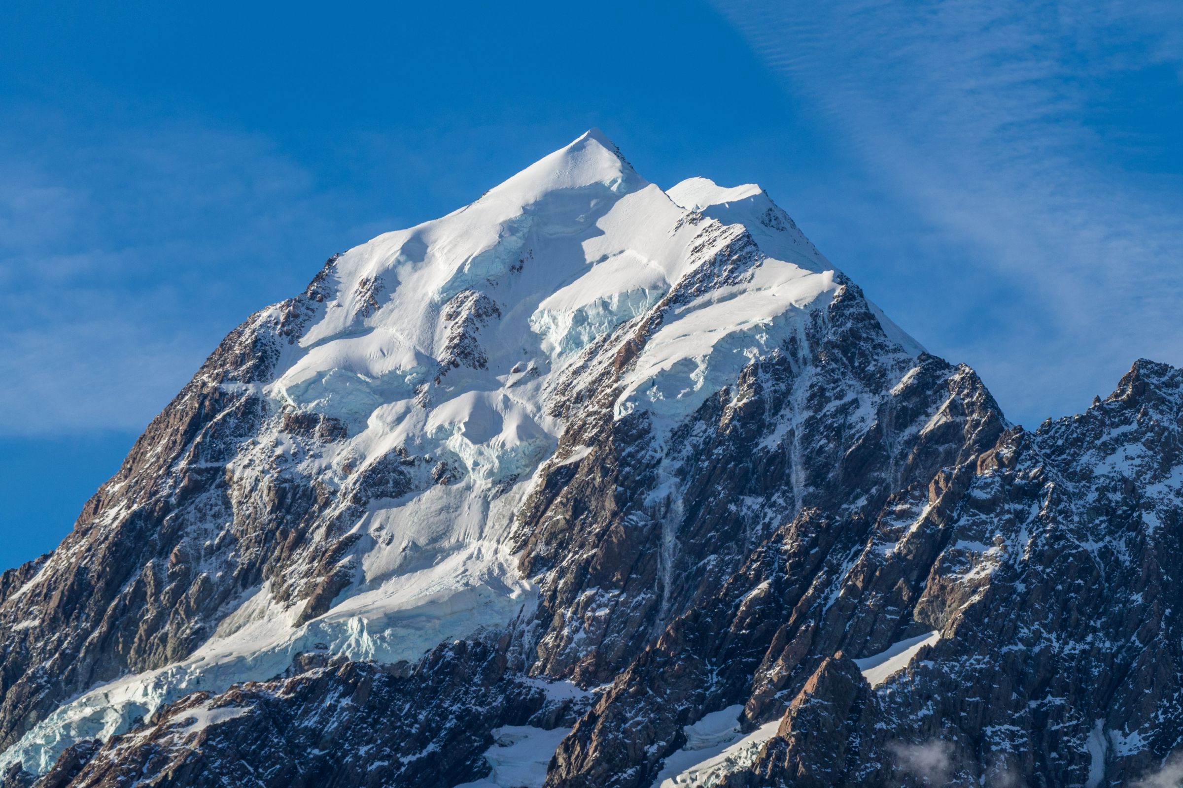
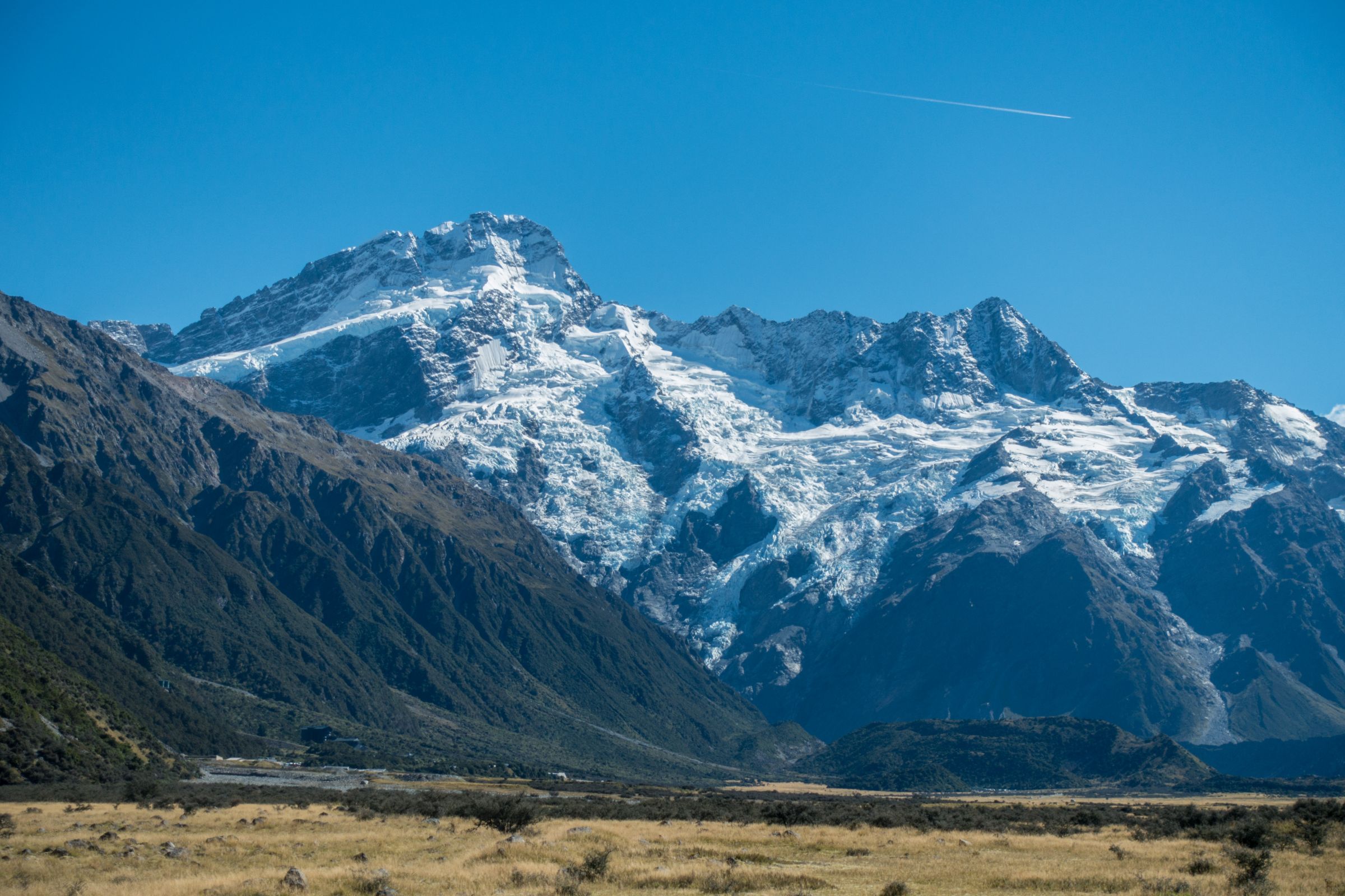
Mount Cook - Aoraki in Maori, one of the most famous places in New Zealand, is exceptional in all types of weather. It is the highest mountain in NZ at a height of 3.724 m/12217 ft.
Aoraki view from the hotel
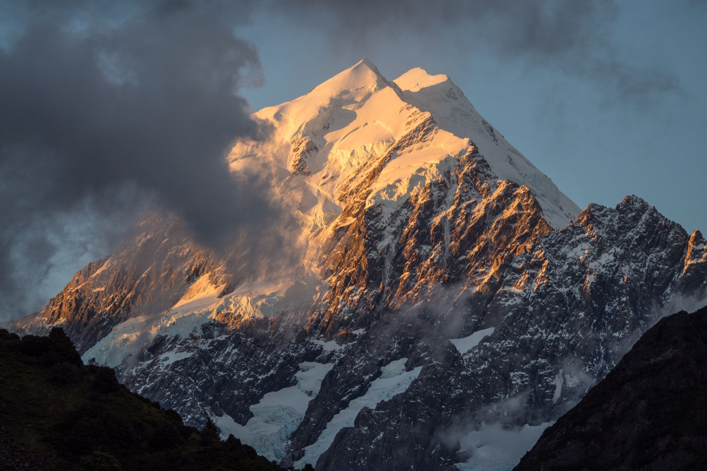
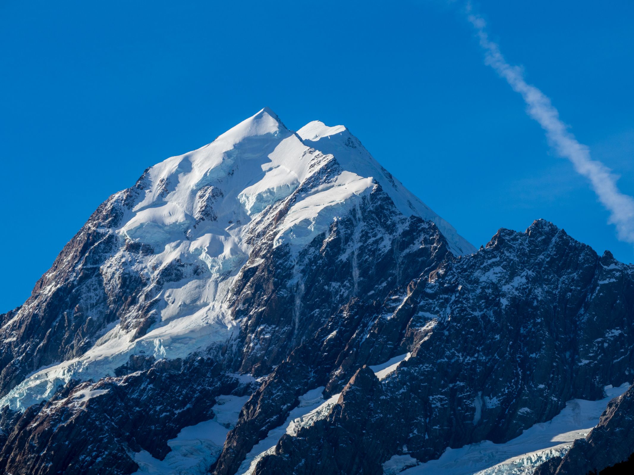
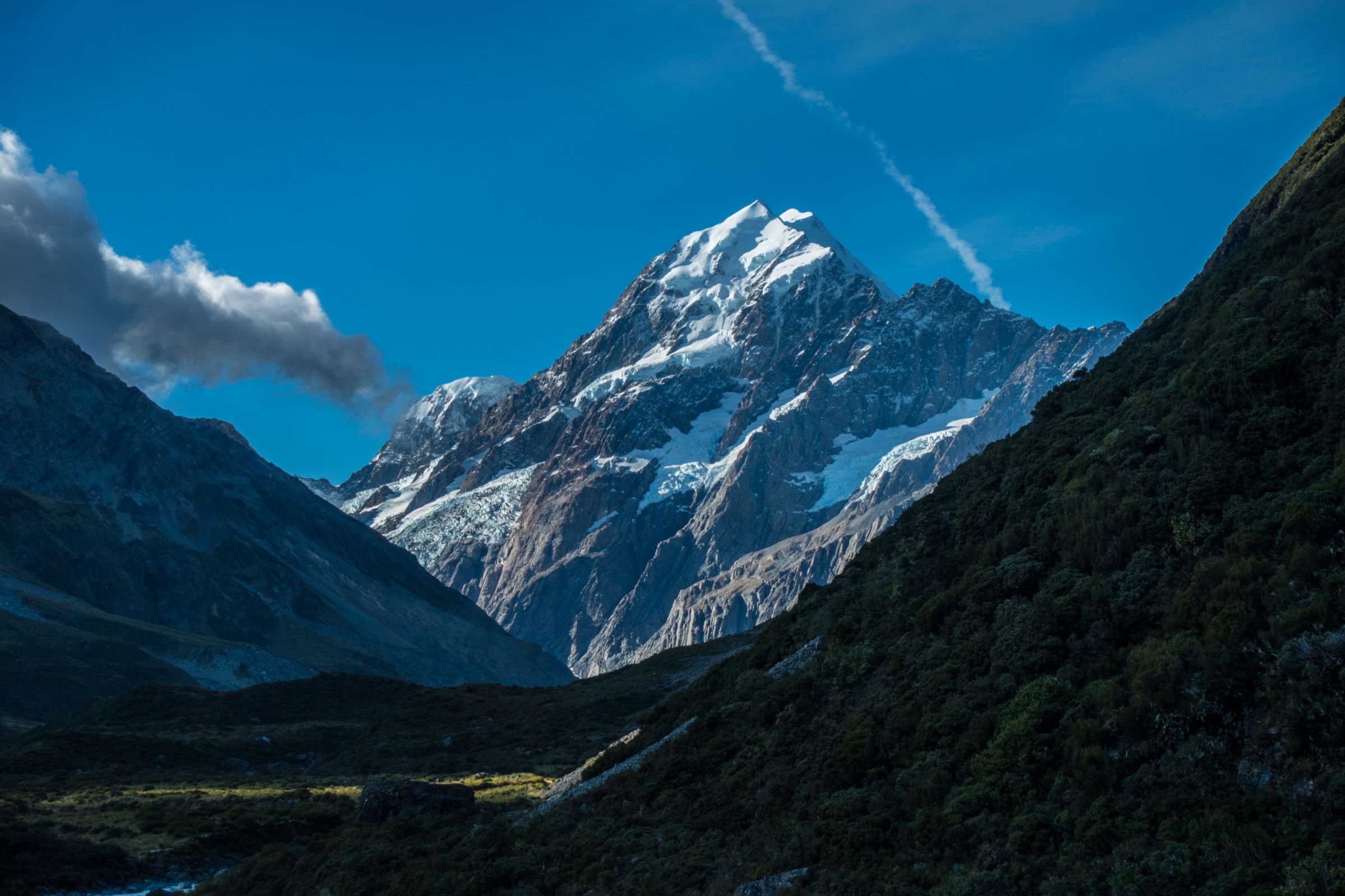
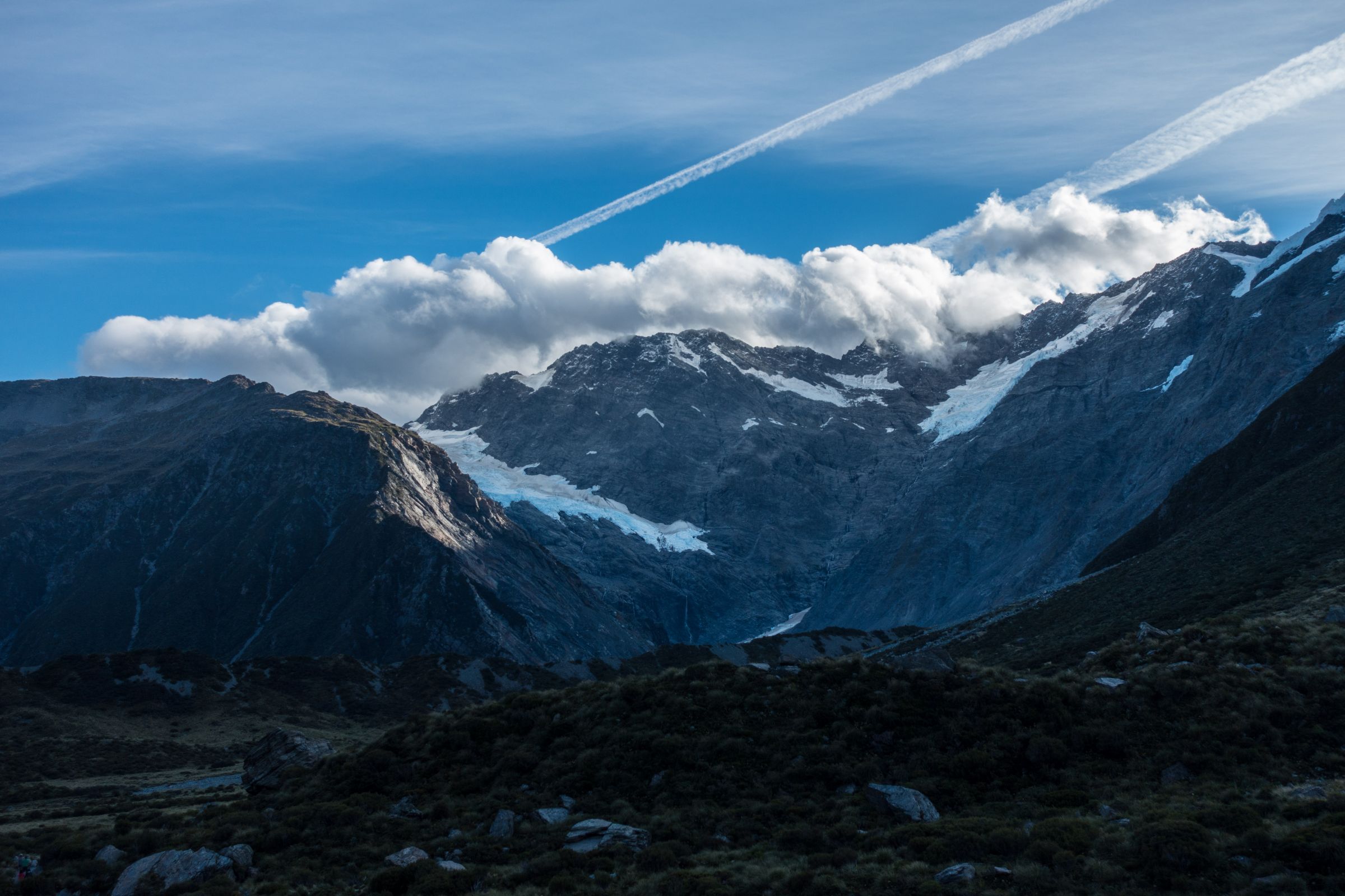
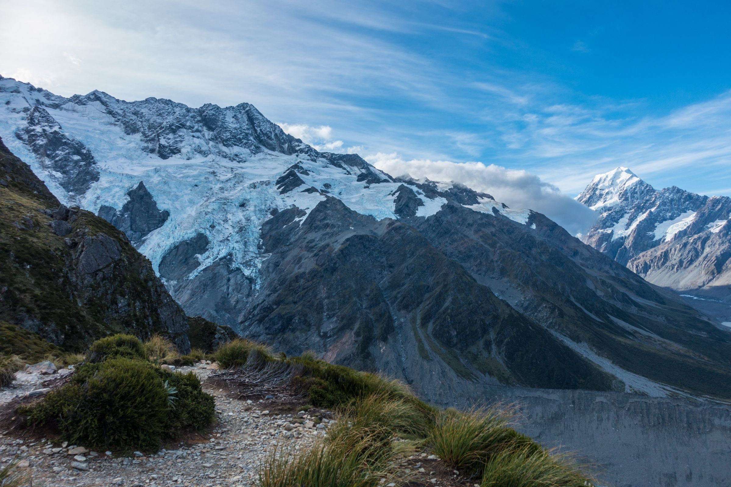
The summit of Mount Cook is covered in snow the entire year. Forty percent of the National Park is covered by the largest glaciers. Nineteen of the peaks are more than 3.000 m high. This park has lots of superlatives. Weather Forecast Aoraki summit; almost always minus degrees.
The Hooker Glacier at the end of the trail.
Mount Cook is a marvellous destination throughout the year. The best times are from October to April if you wish to hike some of the tracks. The crowds thin out as soon as you start hiking one of my recommended trails.
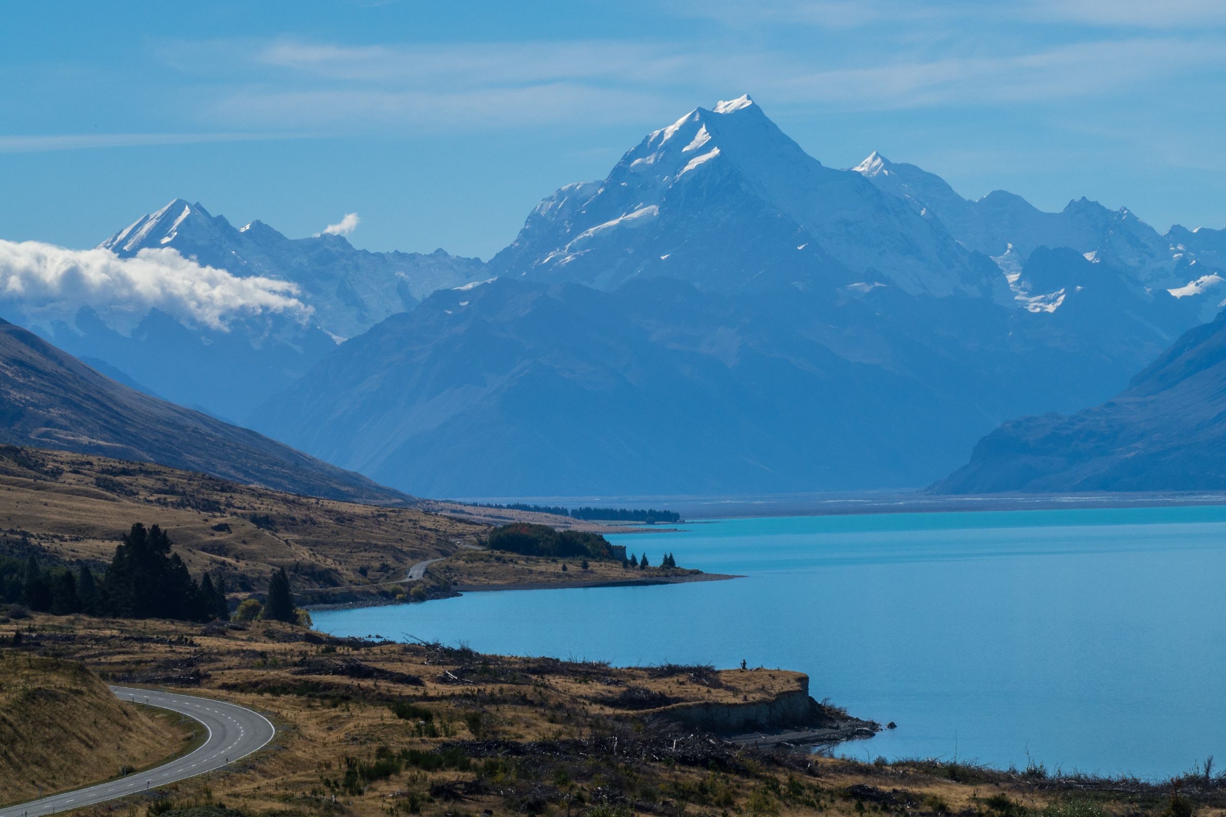
The view from this lookout (Google Maps) at Lake Pukaki to Mount Cook is already promising.
The winter is a little drier but freezing cold with fewer sunshine hours. The summer is pleasant but wetter and busier during the school holidays, and it's even worse around Eastern. If you plan to travel in the summer, you have to deal with crowds and probably days of rain. We went to Mount Cook Aoraki Village for four nights end of March; we experienced excellent weather and snowfall.
The picnic area at the end of the Sealy Tarns Track
Be prepared for four seasons in one day, and you will get rewarded with spectacular hikes and views in one of the most spectacular national parks in New Zealand. Read my season guide below, my advice on why Aoraki/Mount Cook is worth visiting, my 5 Must-Do Walks and Hikes,the best tour the 3-hour heli hike, as well as my 9 Tips for Mount Cook and check out my map to get an overview of this spectacular national park with its snow-capped mountains.
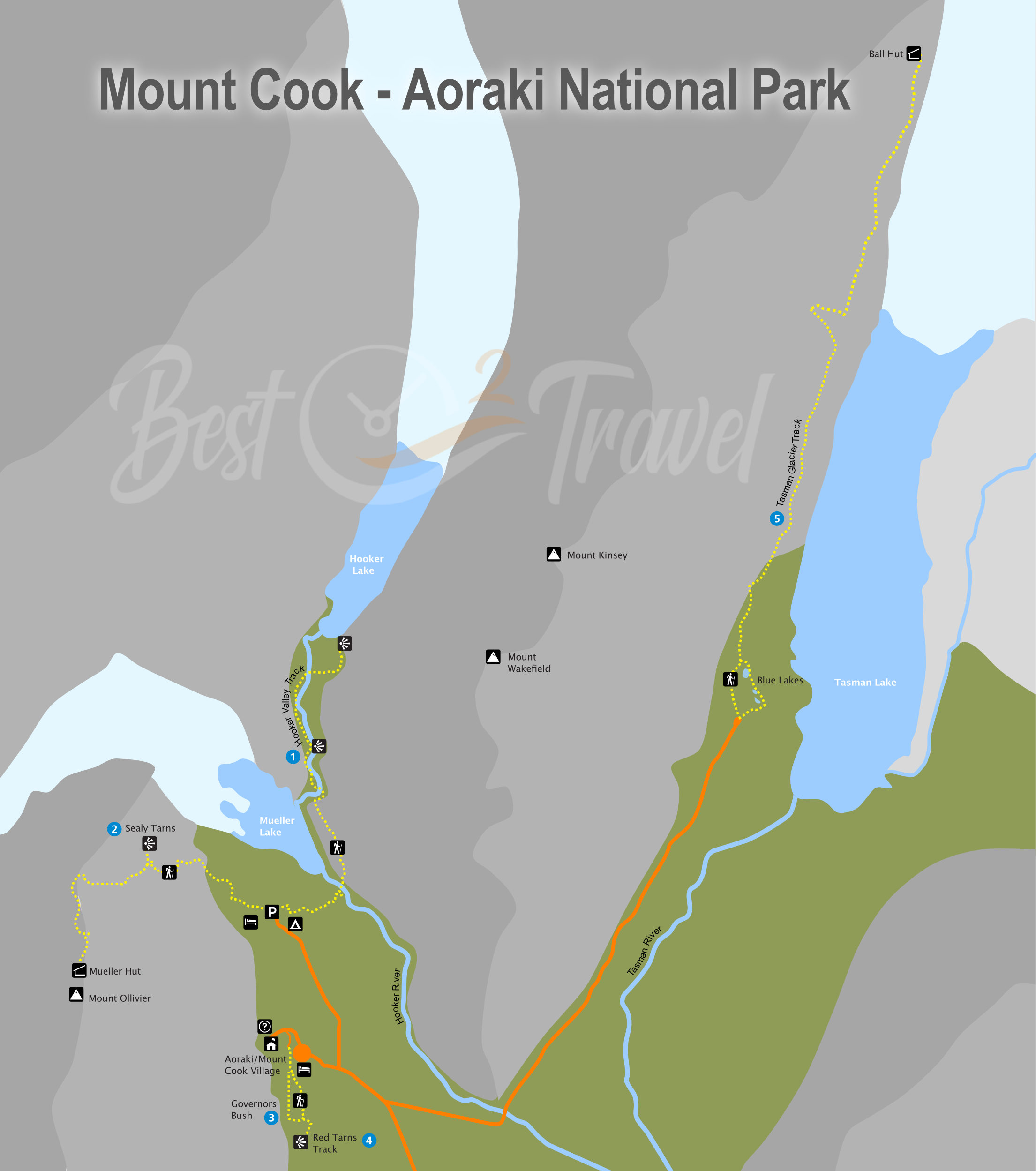
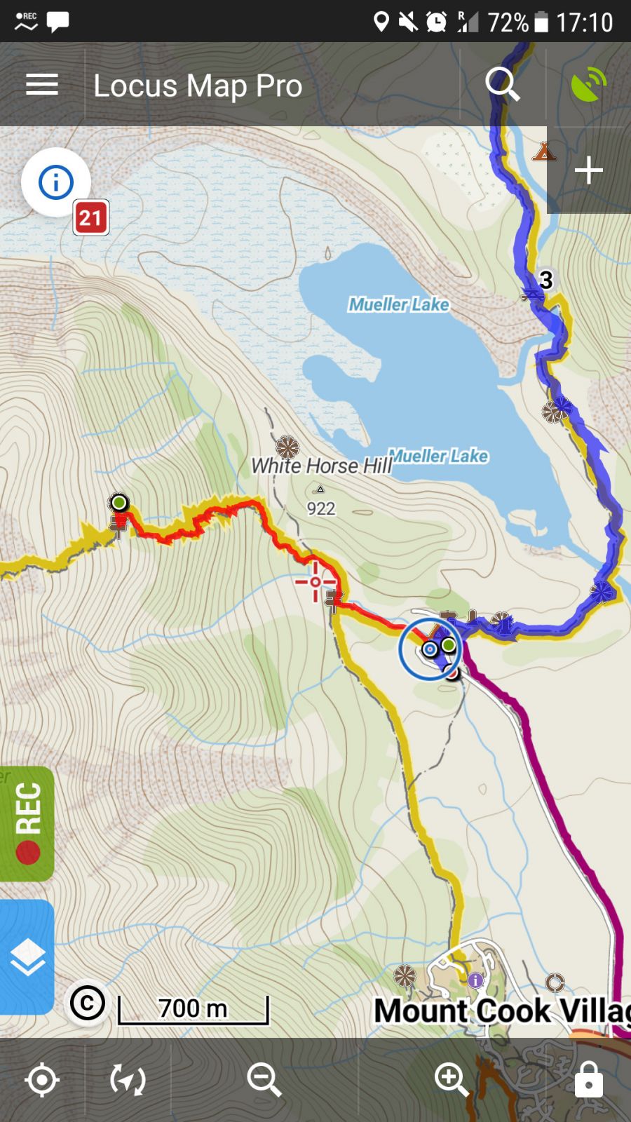
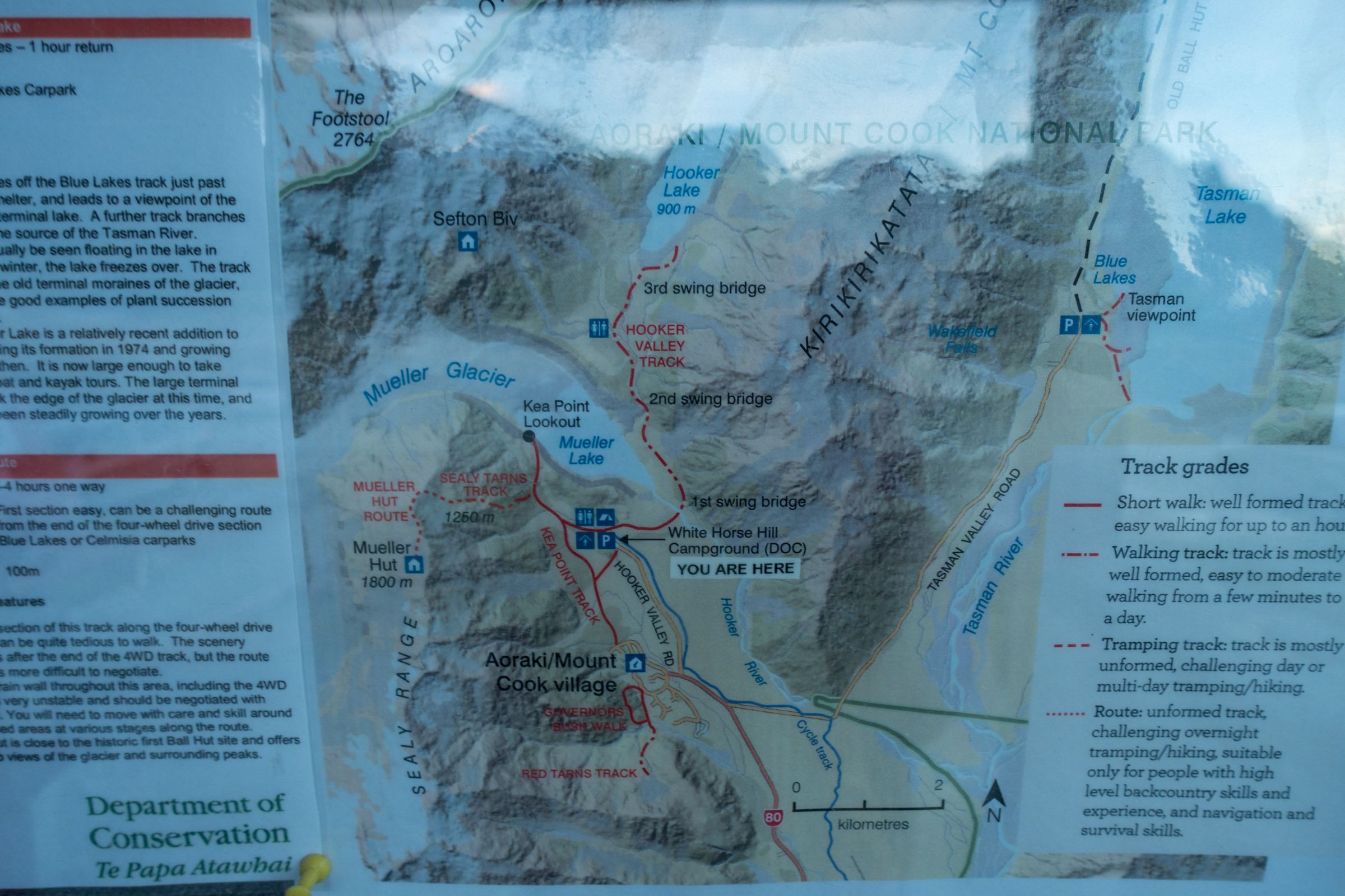
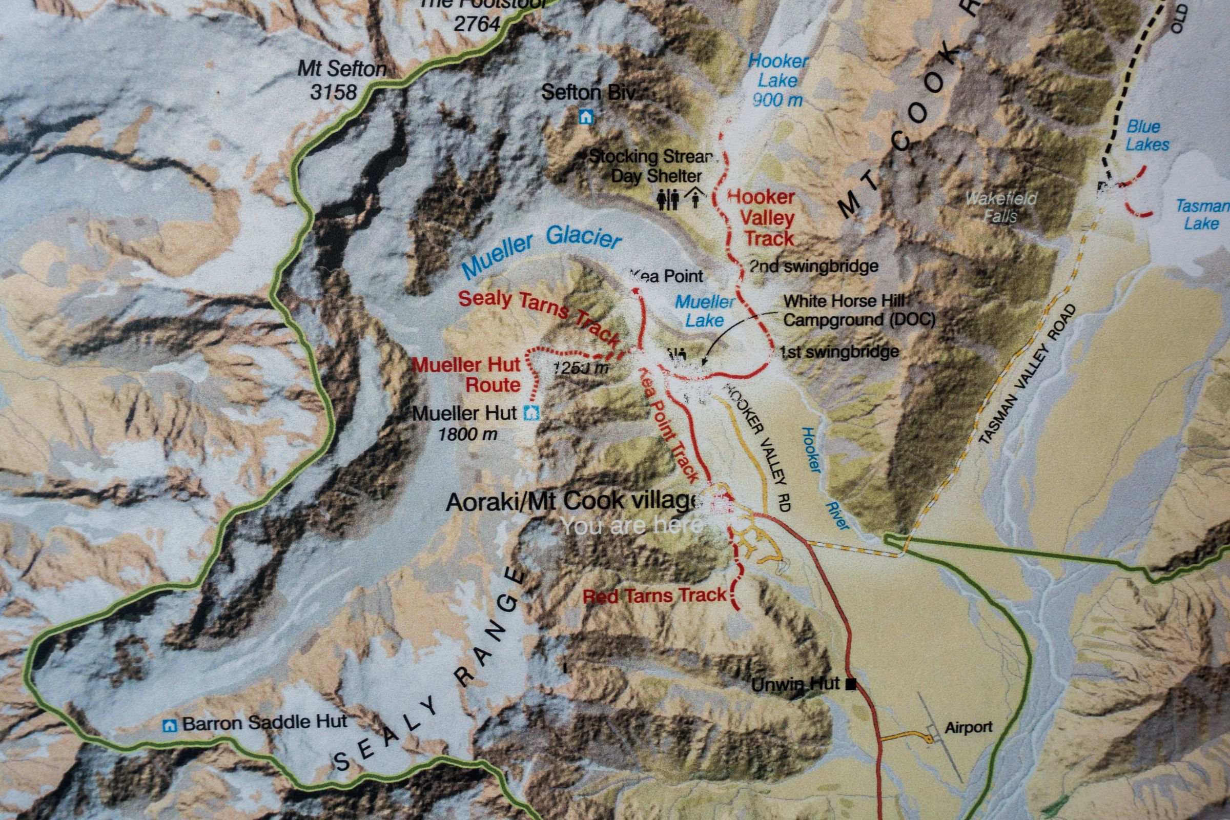
Mount Cook Map with all hikes and walks in high-resolution
I created the map for you for a better experience and where to find everything. I hope it is helpful for your visit.
Information Centre
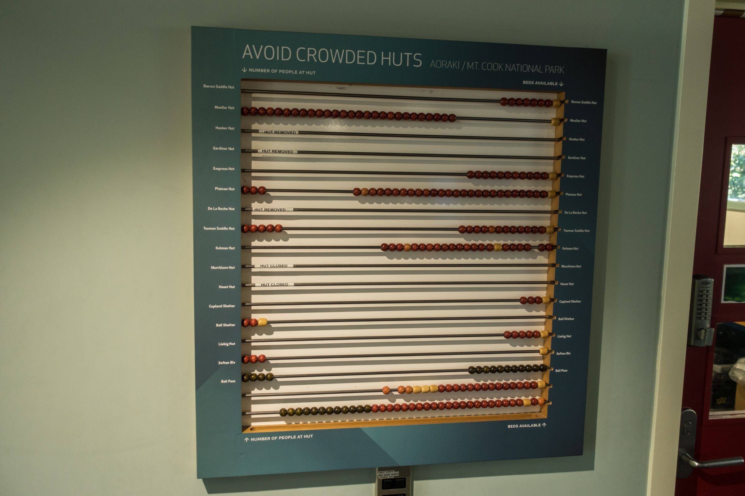
Usually, I don’t spend much time in an Information centre, but this one is different. You get everything you need: helpful advice and a trail booklet for day hikes in the National Park; hut fees are also paid here.
It's perfect for checking out how busy the huts are for overnight hikes.
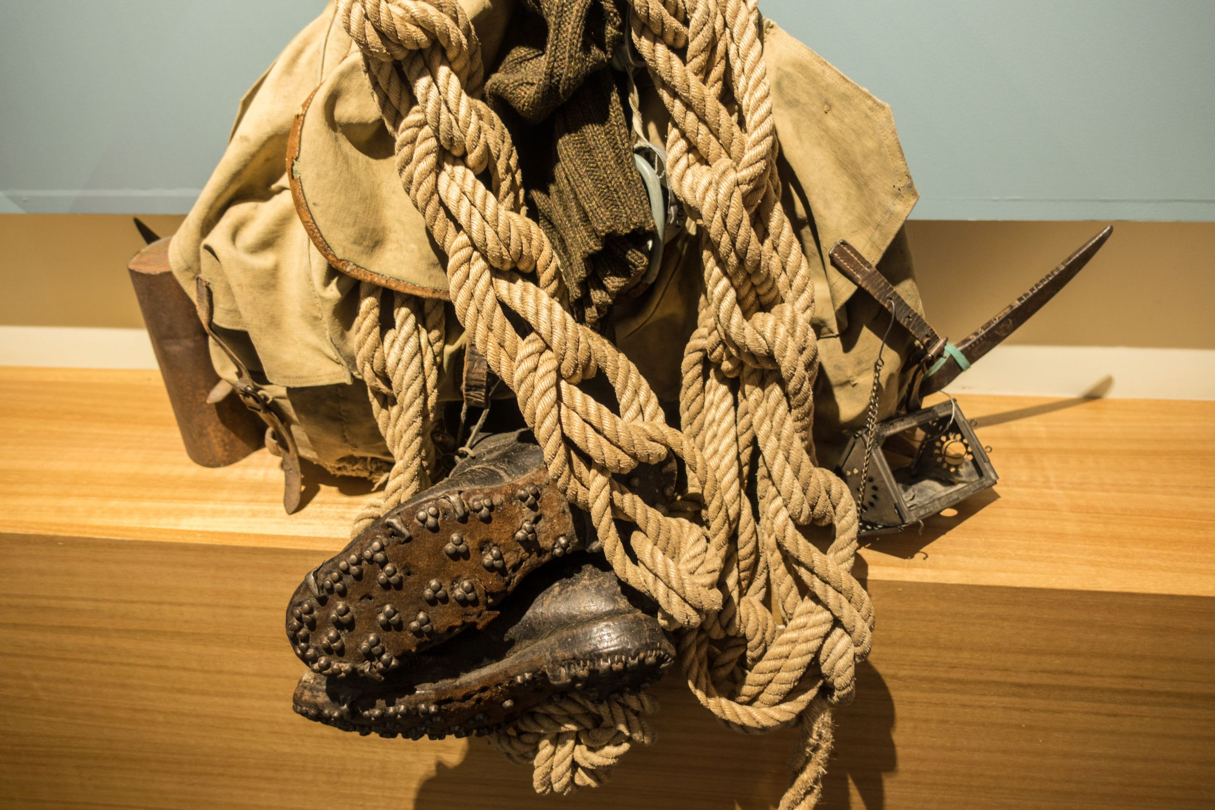
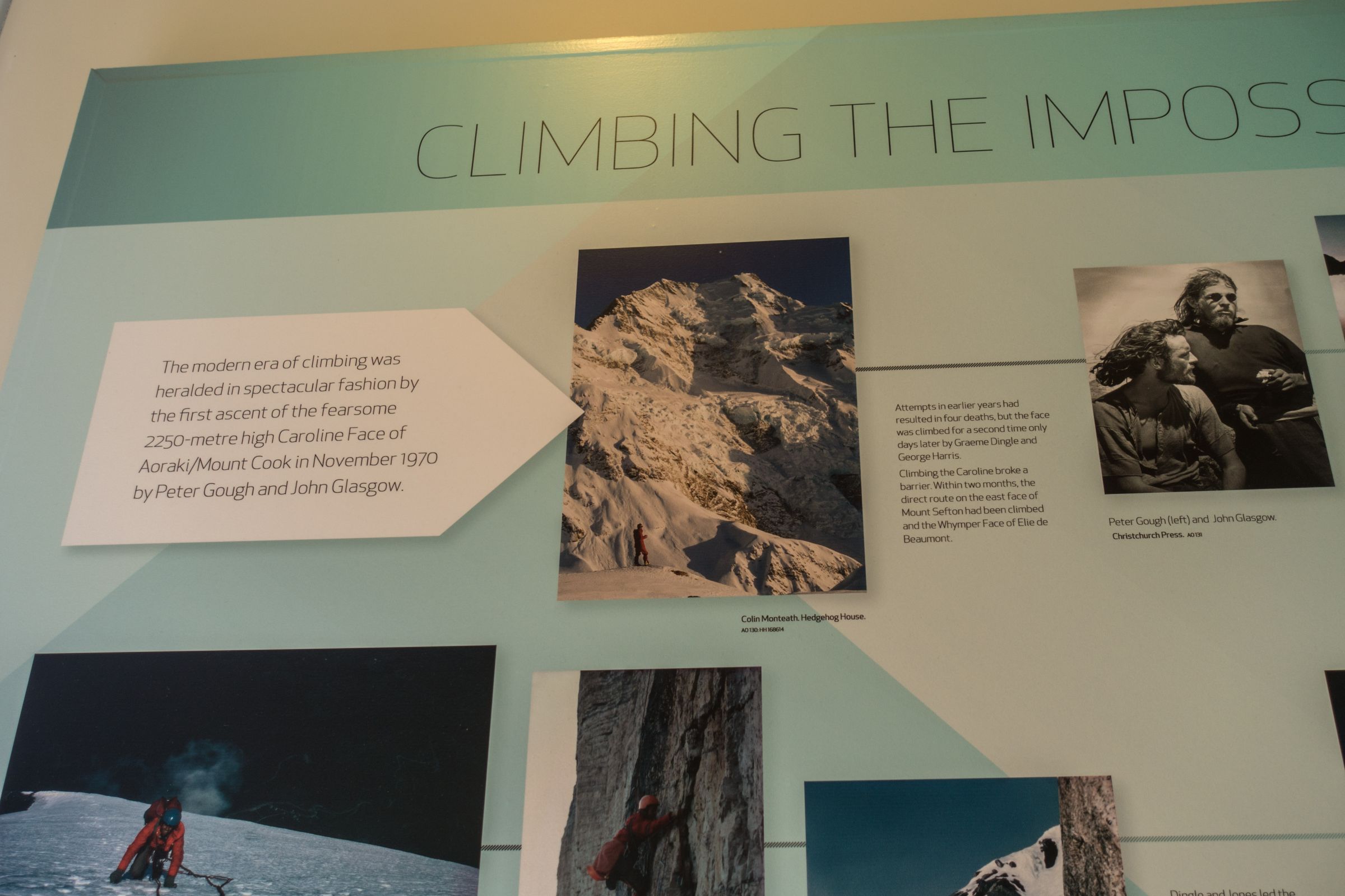
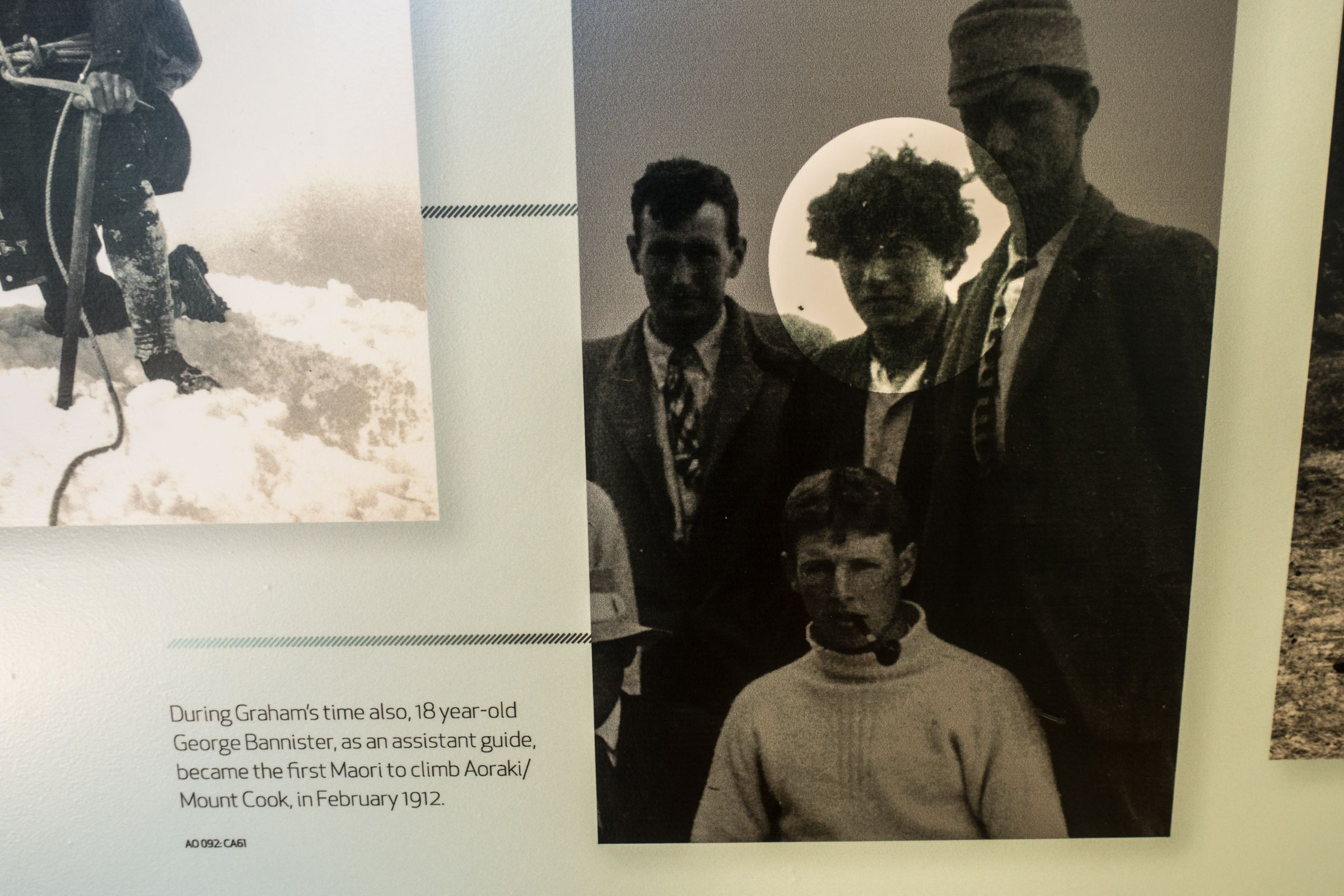
Plan some time for the exhibition about the mountaineering history of Mount Cook, including stories of the Aoraki climbers, first of all, Sir Edmund Hillary, the first woman on Mount Cook, the first Maori, the remembrance books of those who died here, and the climbing gear of the early pioneers.
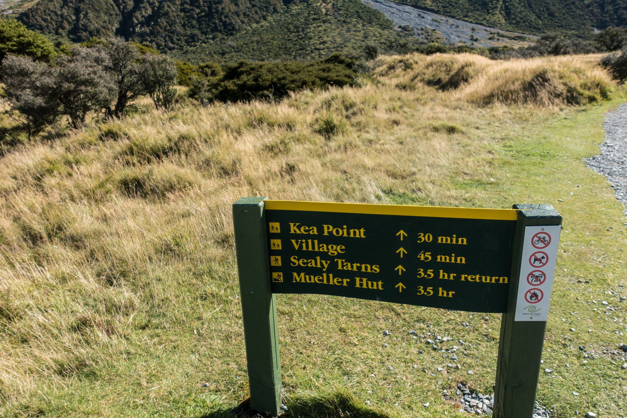
5 Must-Do Walks and Hikes in Mount Cook National Park
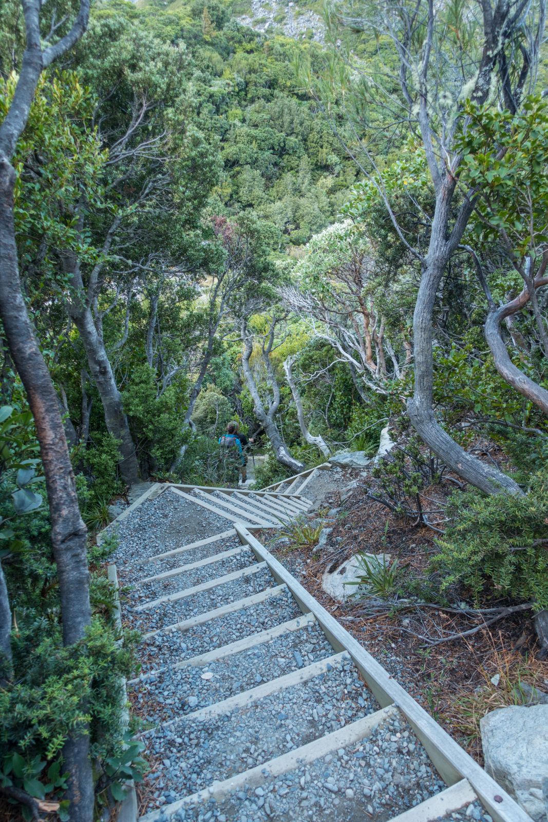
There are different tracks for people of all fitness levels. All walks are well-marked. Restrooms can be found in the village and often at the trailhead but not along the trails. The trails start at the village or campground for the following hikes:
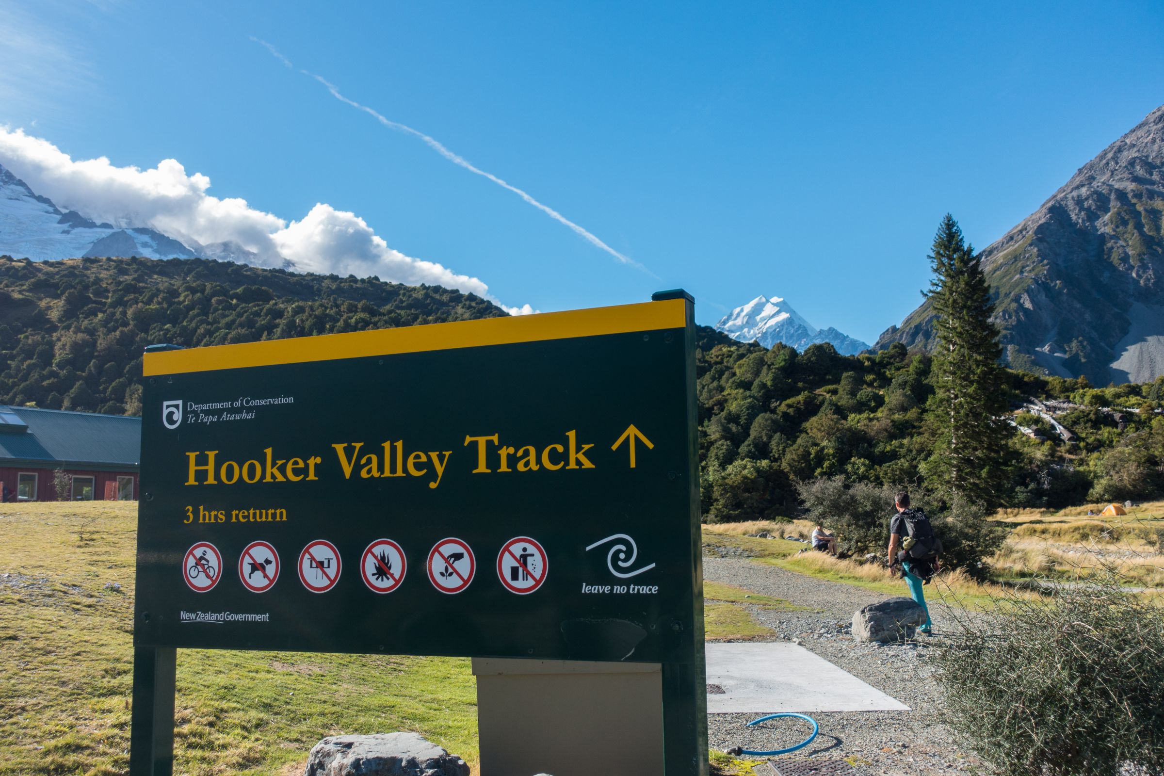
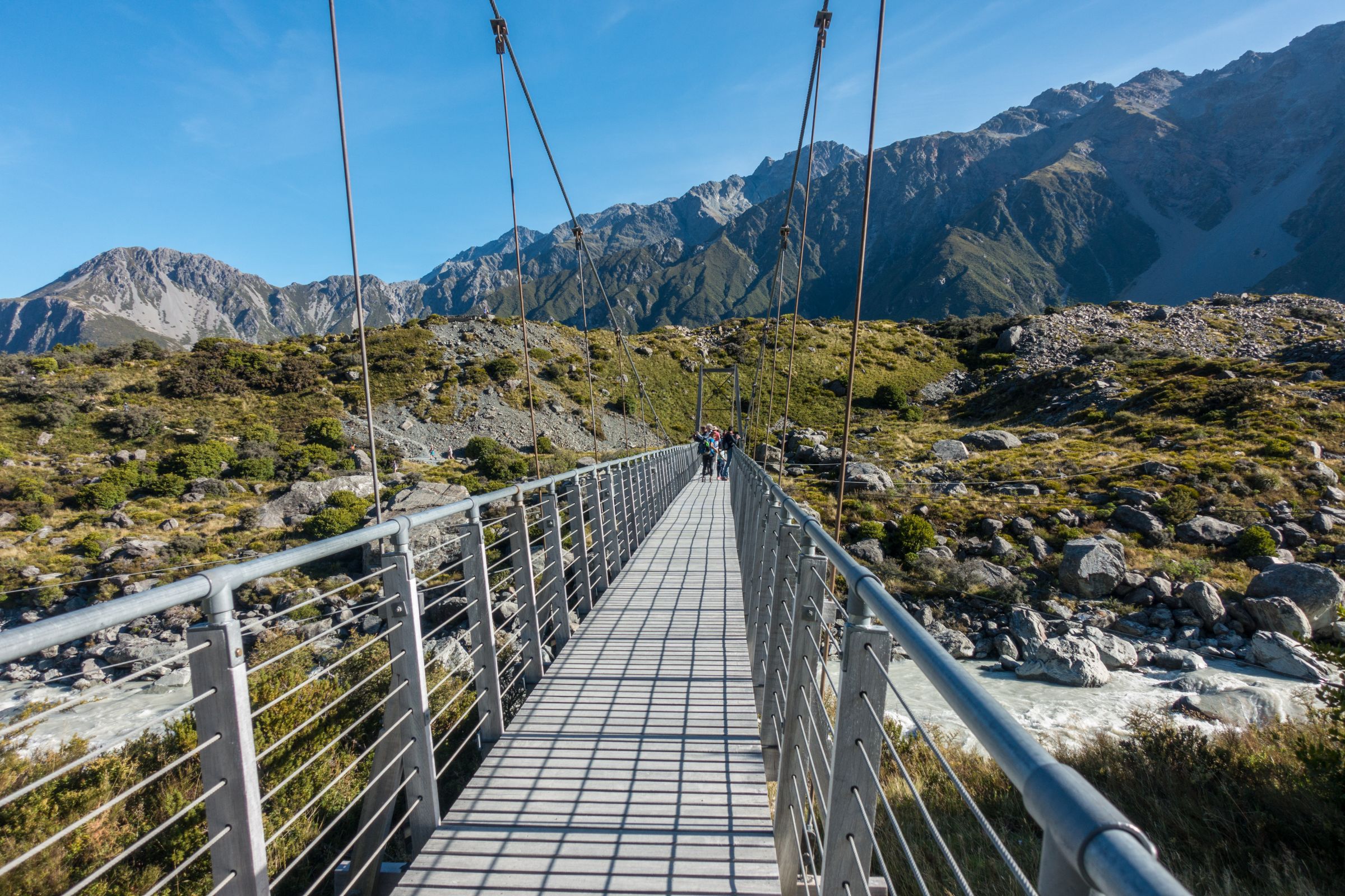
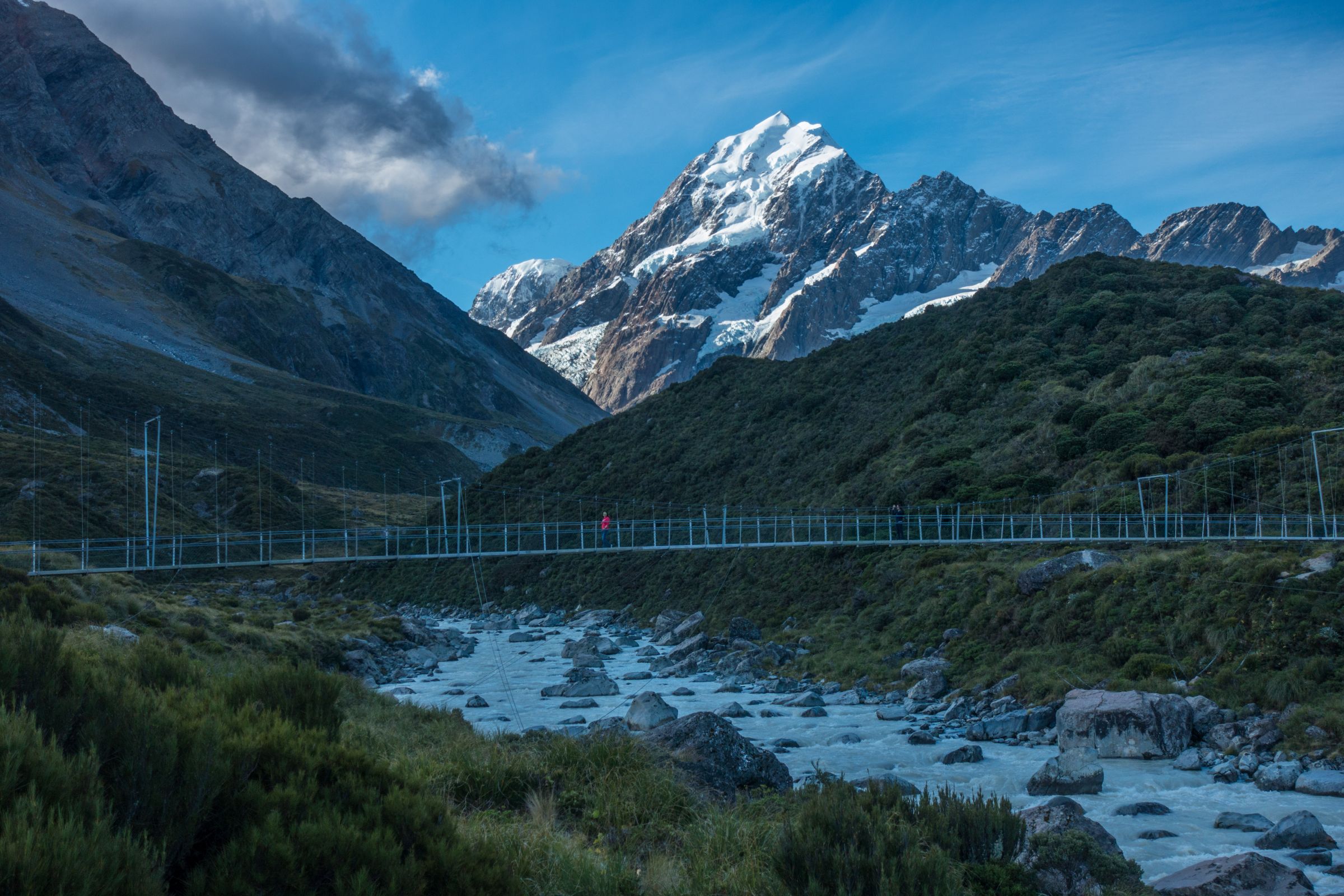
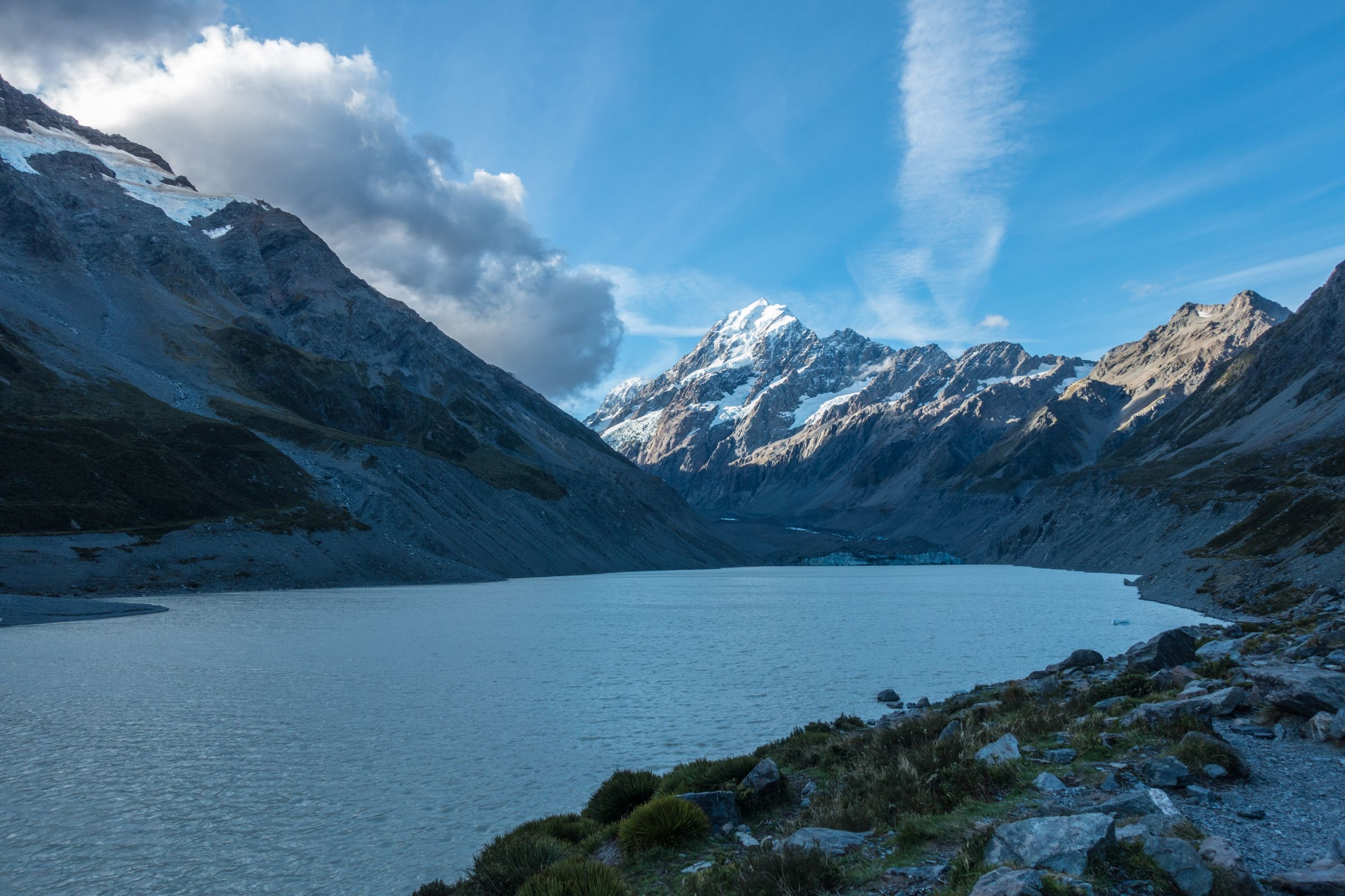
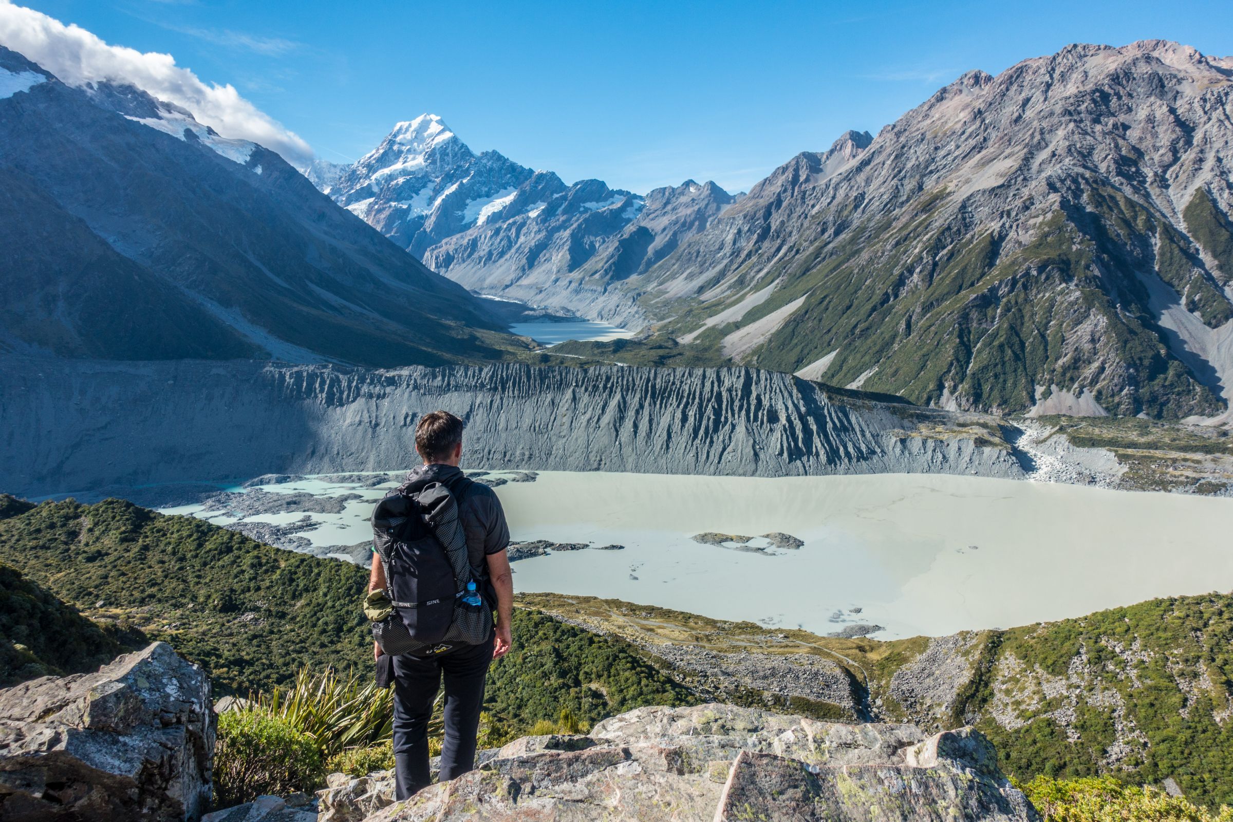
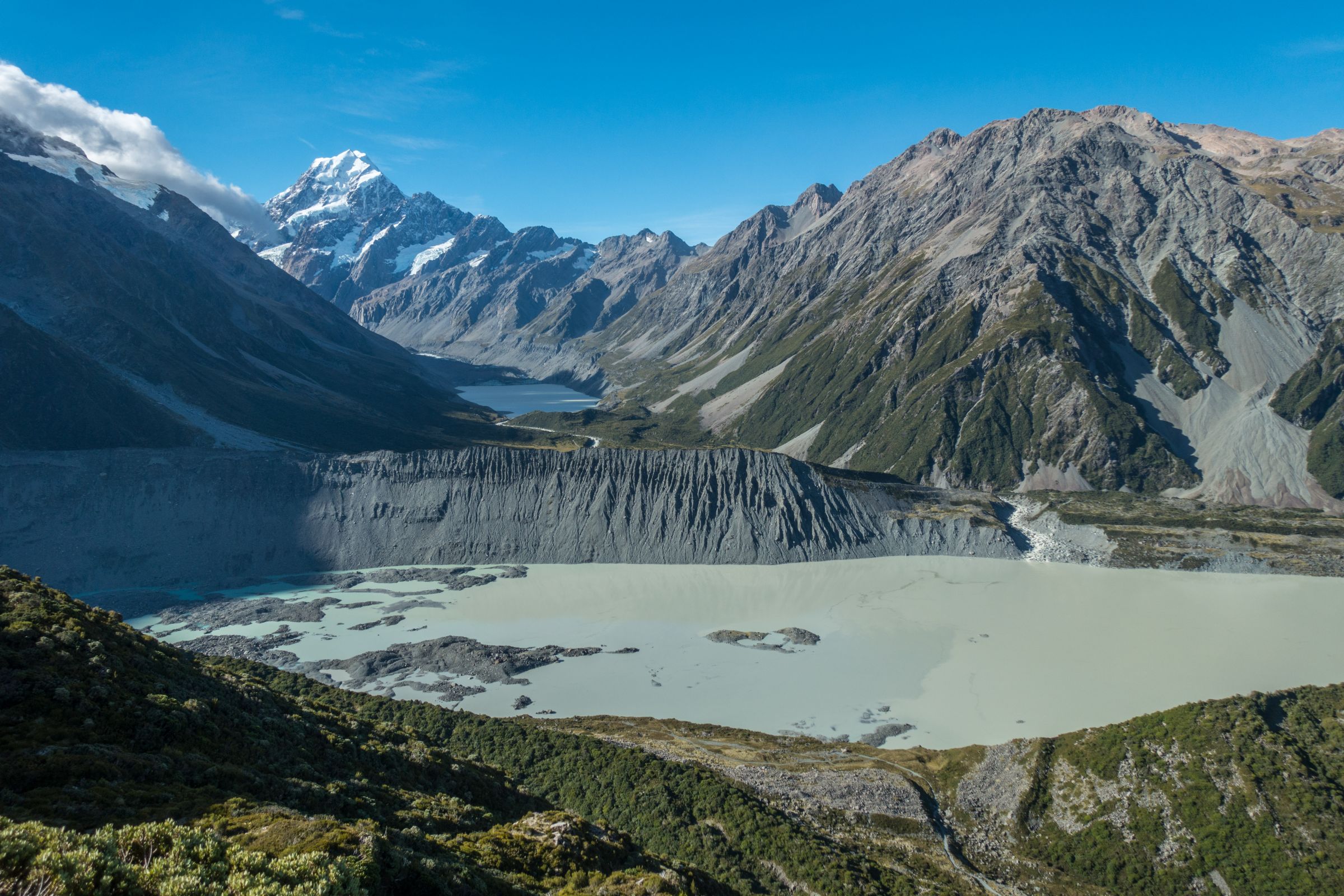
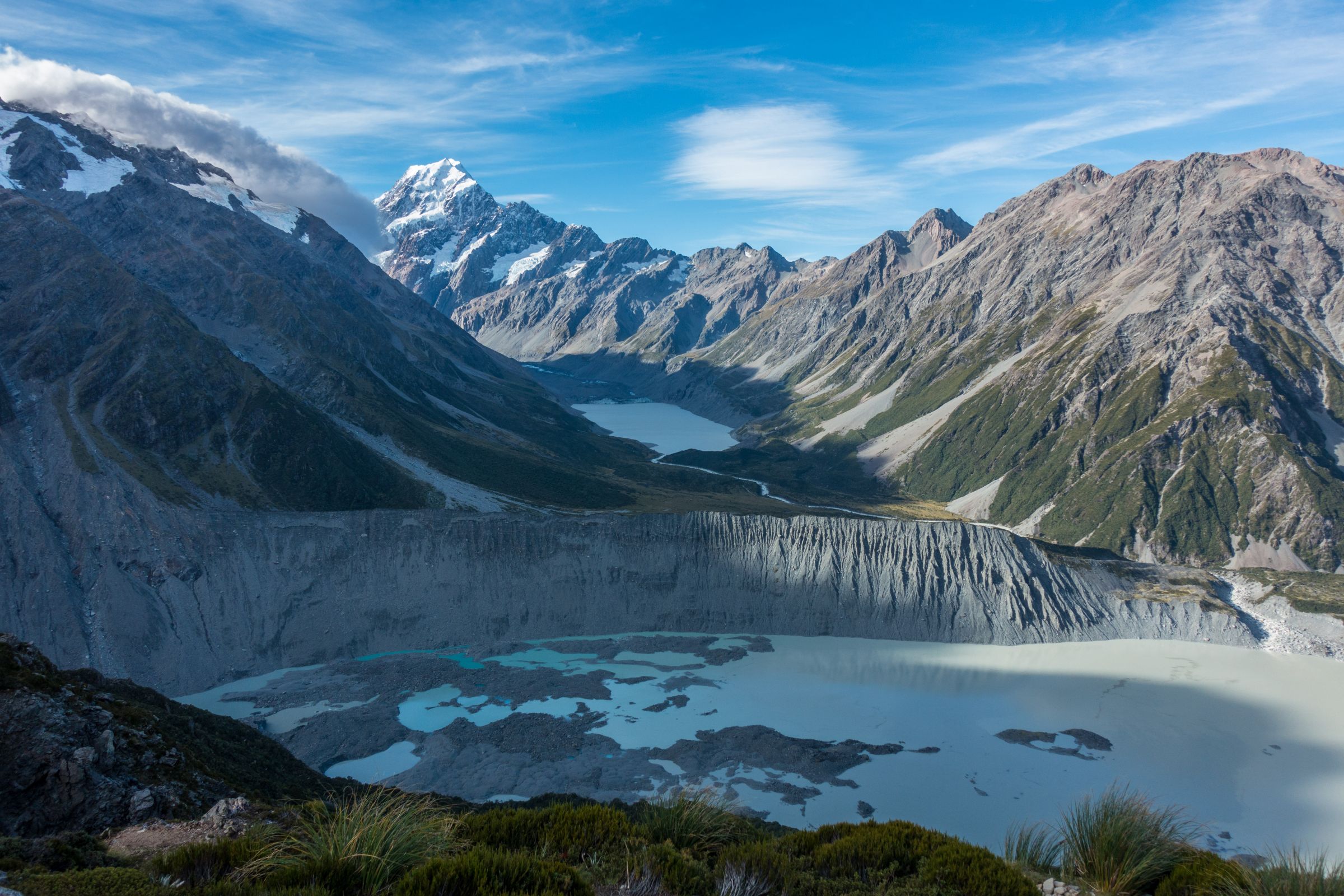
Hooker Valley Track
Parking and Trailhead: The White Horse Hill Campground Google Maps
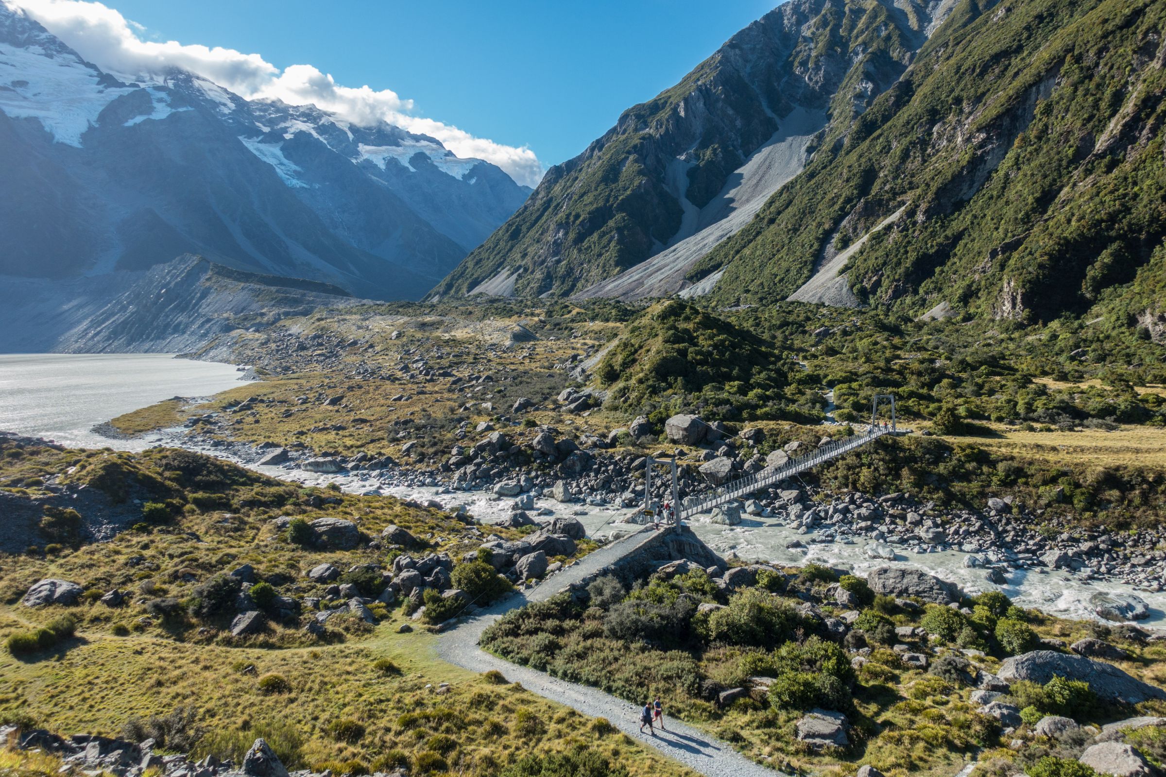
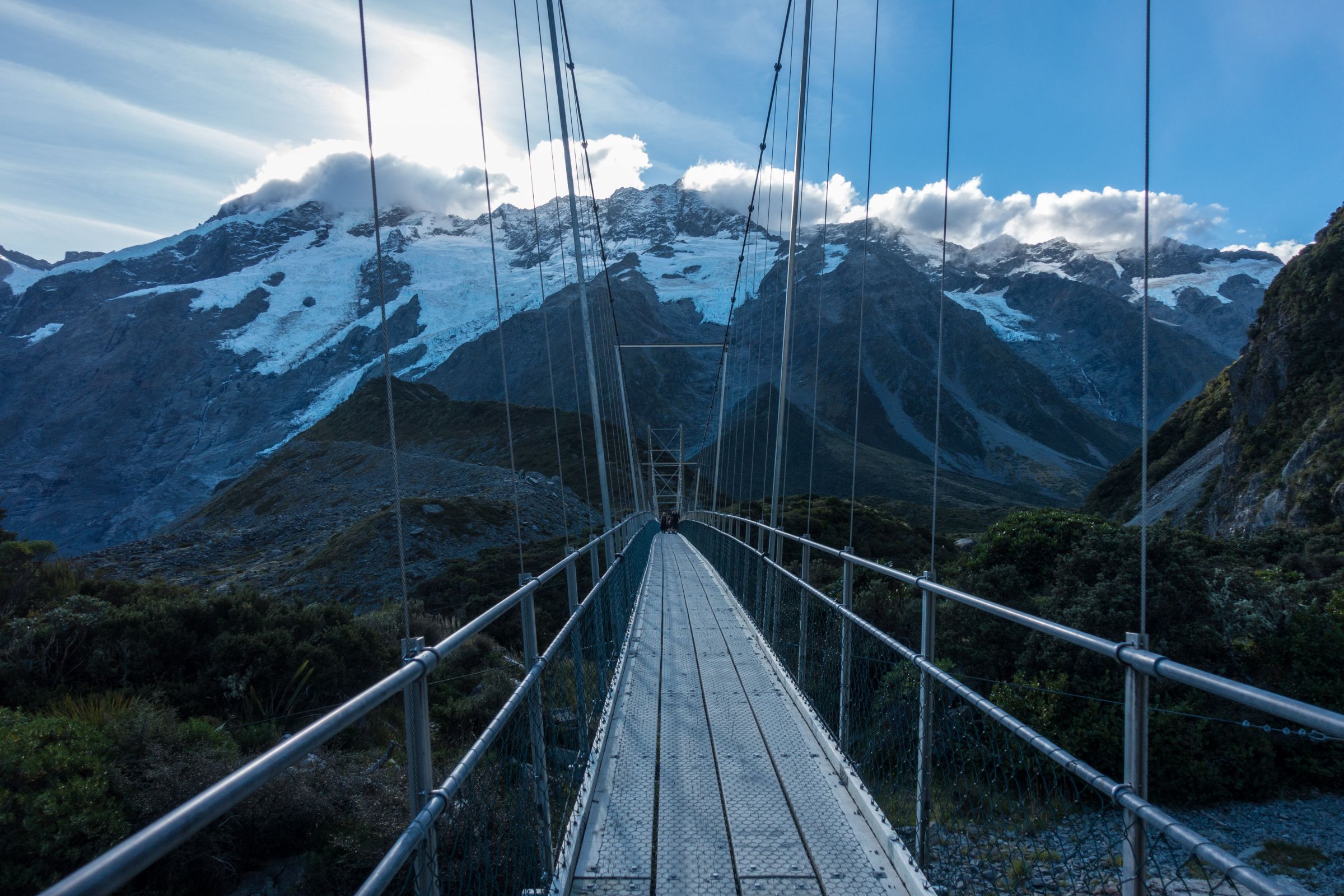
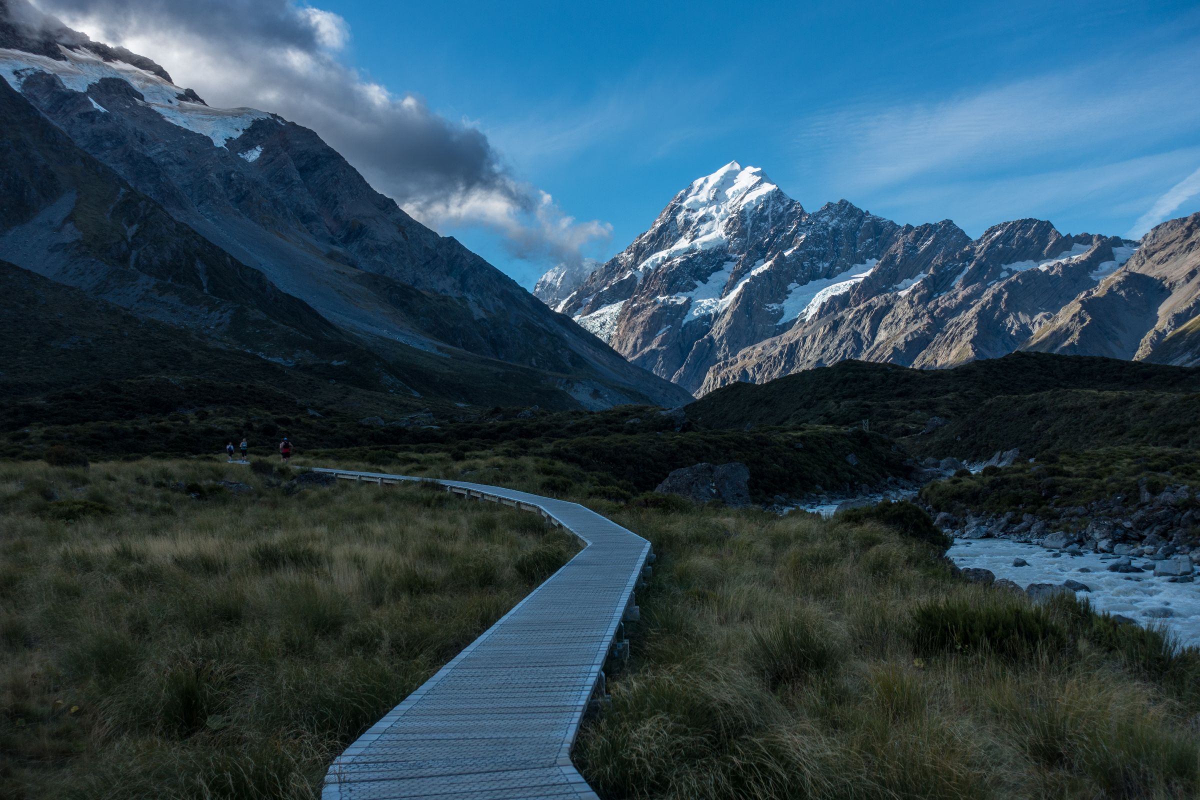
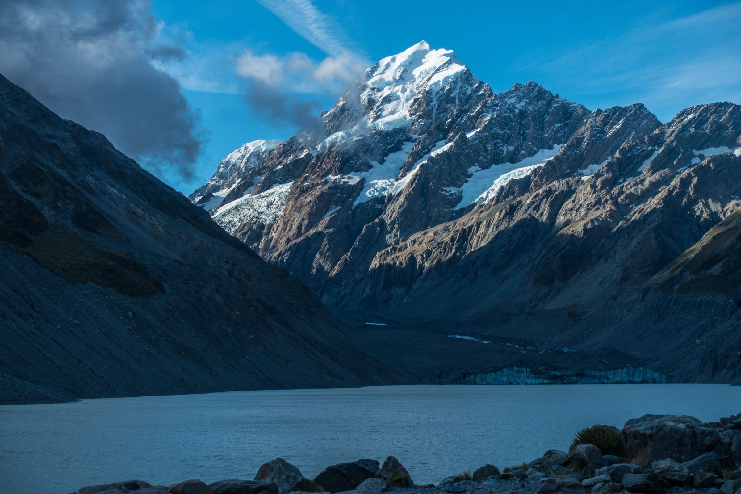
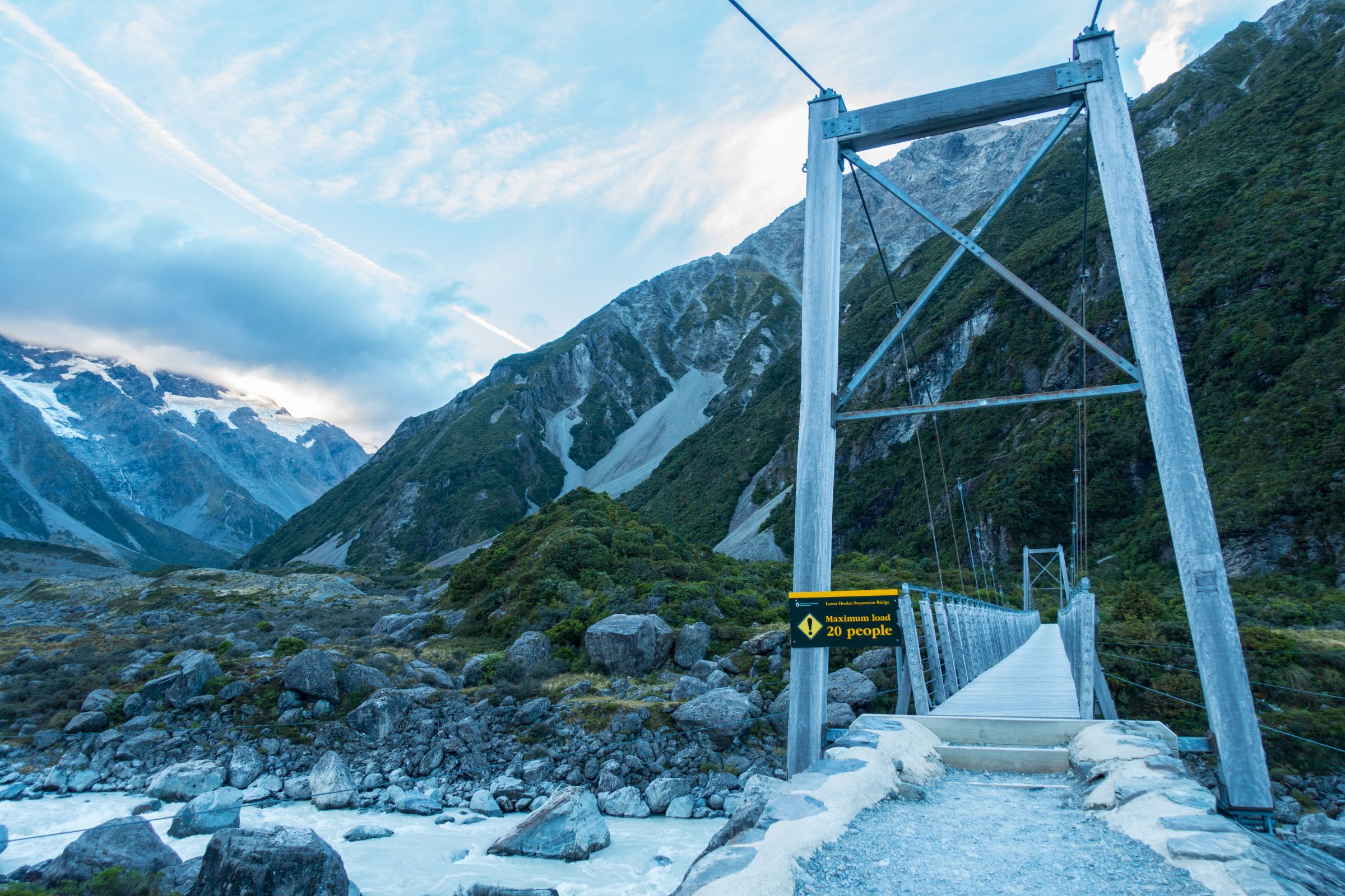
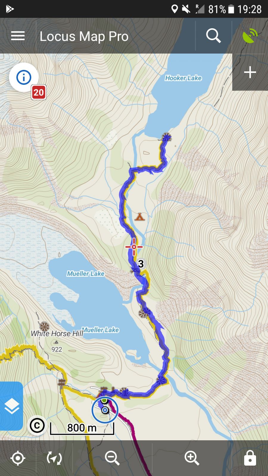
This spectacular hike towards Mount Aoraki takes a good 3 hours to return to enjoy properly. It’s a flat 10 km hike. This trail to Hooker Lake and Glacier has awe-inspiring views and landscapes. It’s an easy walk, therefore, more trafficked but utterly worth doing. The walk passes almost the Alpine Memorial before you come to Mueller Glacier Outlook and the first of three swing bridges. If you are not able to walk the entire trail, hike at least to the first swing bridge, which takes 15 minutes and another 15 to the second. The route ends at Hooker Lake and Glacier, with unforgettable views of the famous Mount Cook. (Map of our track by Locus Map) or bookmark the link for your trip Locus Map Hooker Valley Track - one way with picnic spots.)
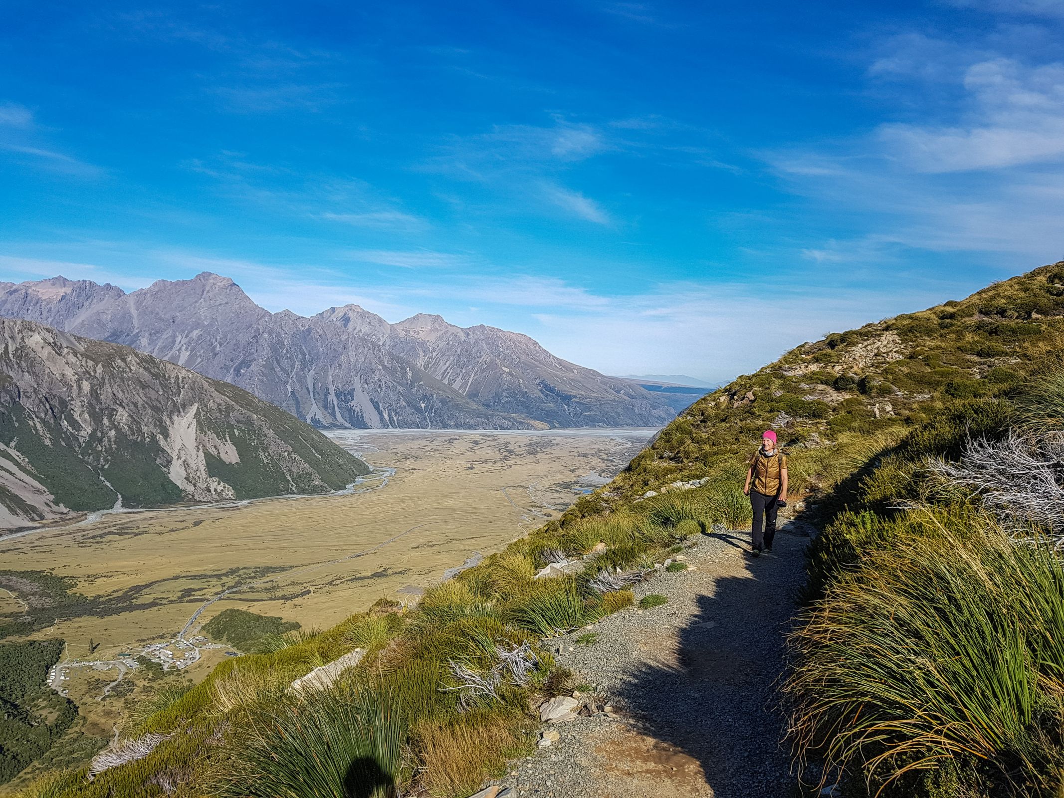
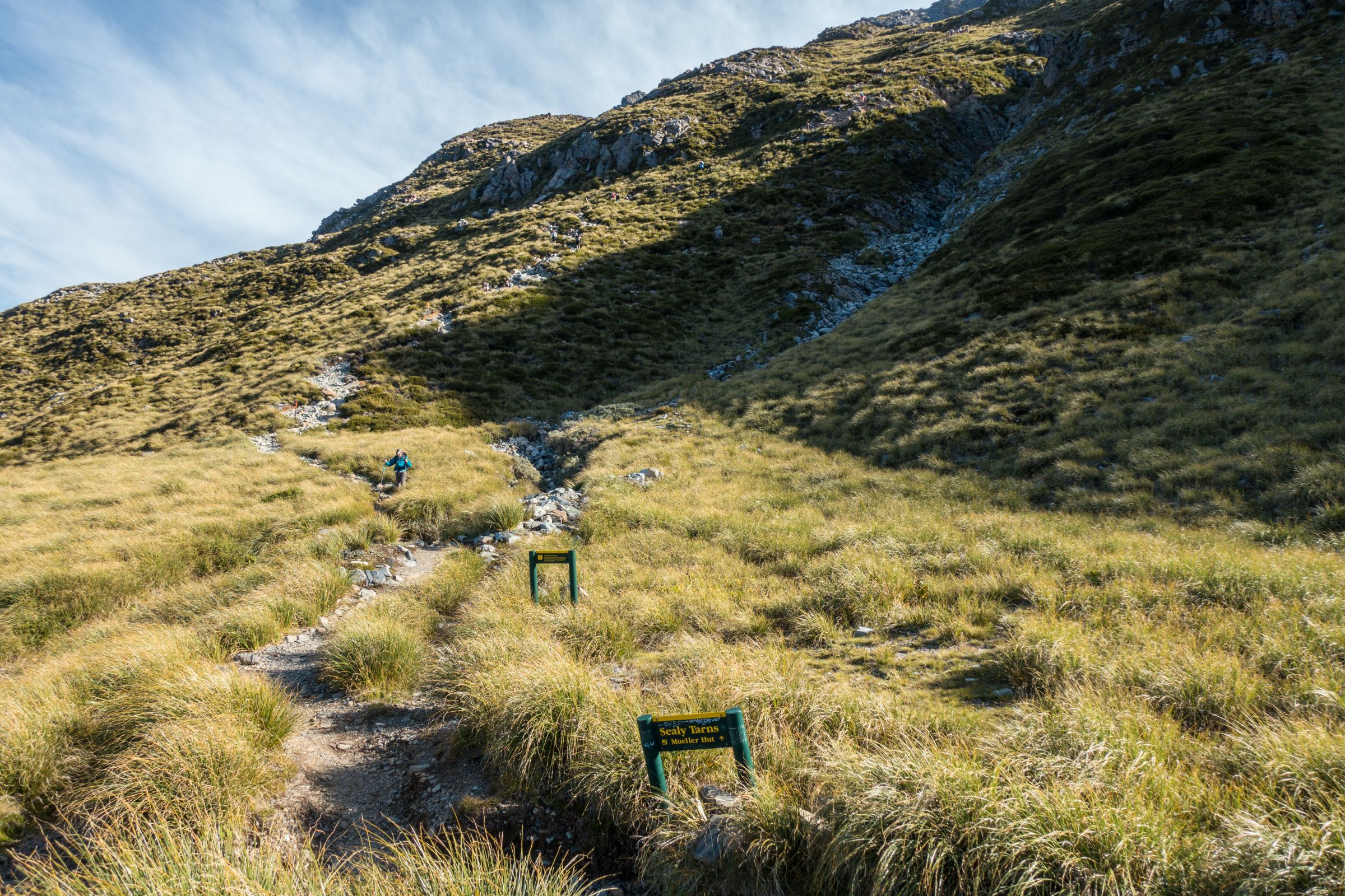
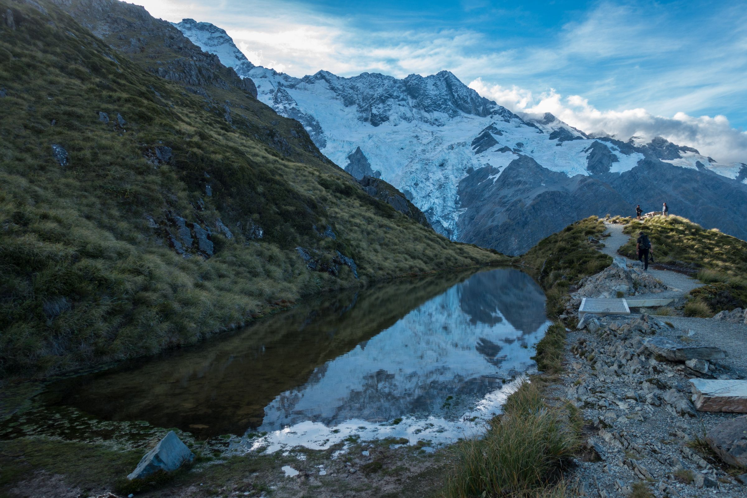
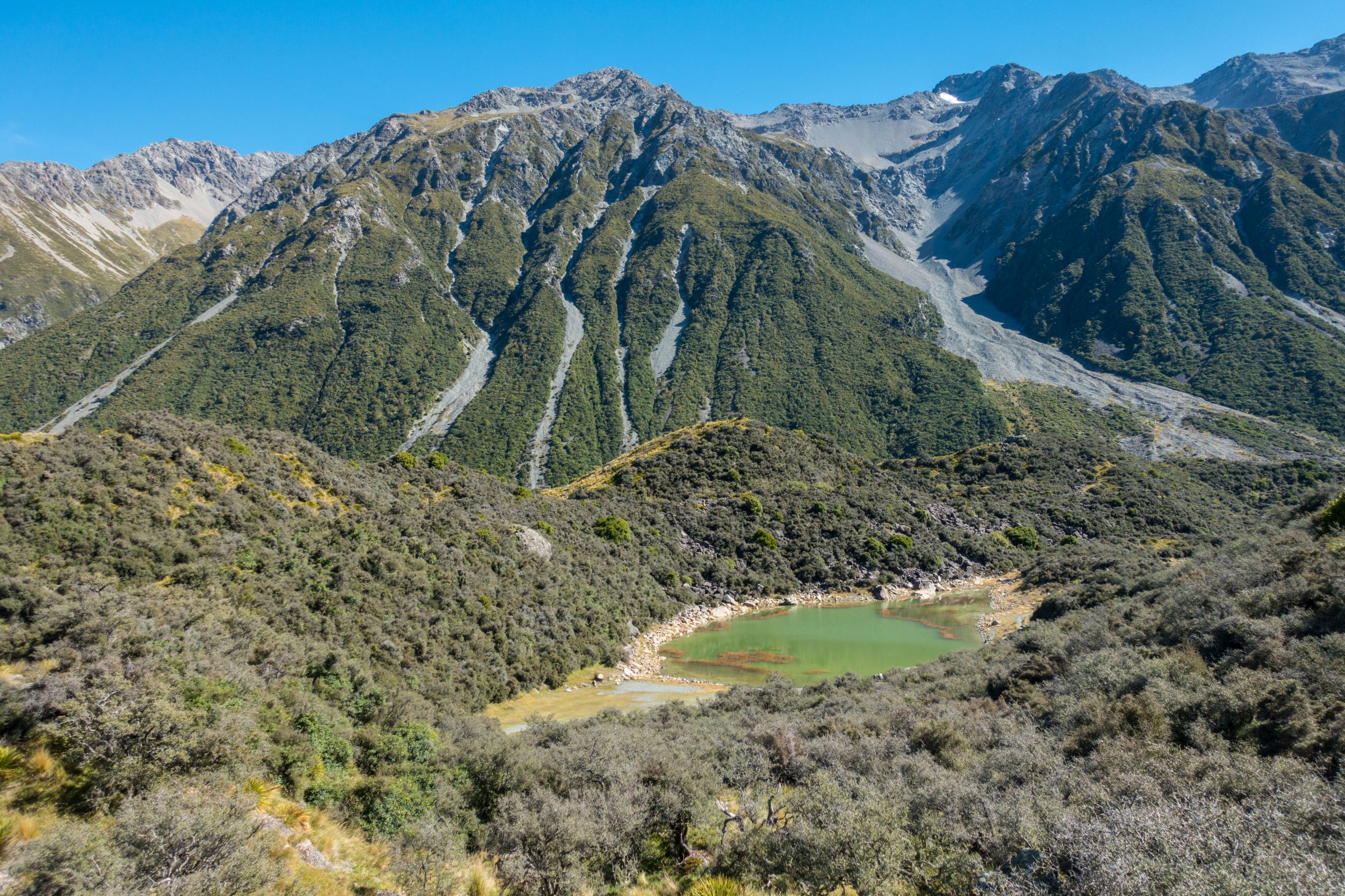
Sealy Tarns Track - Sunset Spot
Parking and Trailhead: The White Horse Hill Campground Hiking Map by Locus Map to Sealy Tarns, which continues to Mueller Hut
Famous for magnificent sunsets during summer. It’s a steep leg burner trail with endless steps to protect the path from destruction during poor weather. Markus on the steep Sealy Tarns Track It’s almost halfway to Mueller Hut and takes 3-4 hours to return. An elevation gain of 600 m climbs up to the picnic area and trail end. You get rewarded with jaw-dropping views of Mount Cook the higher you get. At the end of the track is a huge picnic table. Google Maps Location of the Sealy Tarns Viewpoint.
Bring a picnic in your backpack and enjoy the majestic Aoraki Mount Cook. Keas, the alpine parrot, is often around. If you are an experienced hiker, start in the early afternoon and wait for the sunset. Bring a torch for the way back. Don't rush the track - take your time!
Governors Bush
Parking and Trailhead: Aoraki Mount Cook Village
This is a short circular trail that takes a maximum of an hour. You get a glimpse of this National Park's silver beech and forest. If it's quiet, you may spot birds here. An easy climb leads to an outlook with a great view of Mount Cook. Hiking Map by Locus Map App
Red Tarns Track
Parking and Trailhead: Aoraki Mount Cook Village
This is another terrific hike with magnificent views of the valley, village, and Aoraki Mount Cook. It is also an excellent spot to watch the sunset. Another advantage of this 2 h - 5 km return hike is that if Mount Cook and the surrounding mountains are covered in clouds or it rains. This trail is located in the distance and may be dry. You still may have a good view without rain. The steep route has many steps, like the Sealy Tarns Track, but this trail is just a 300 m climb up. Hiking Map by Locus Map App
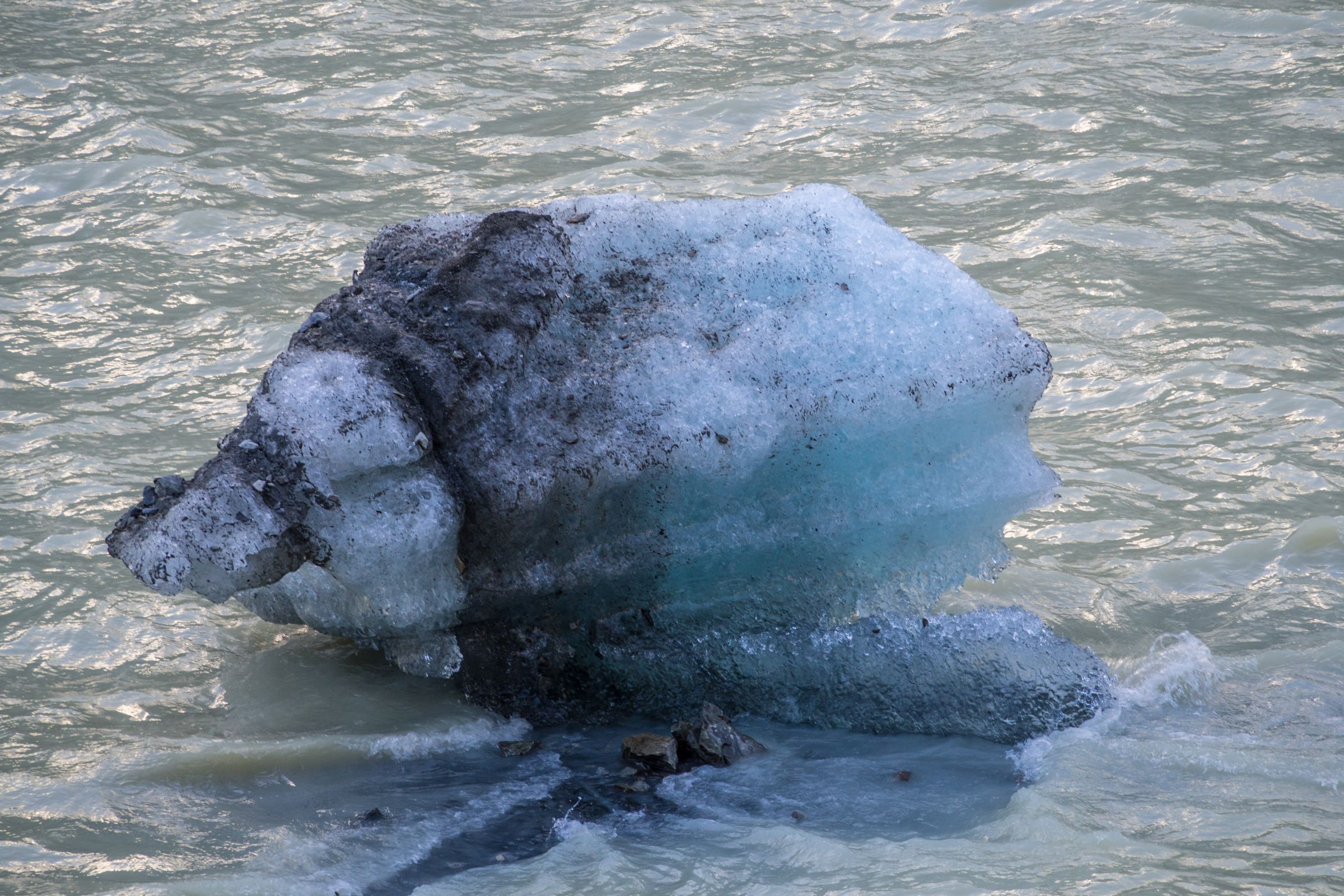
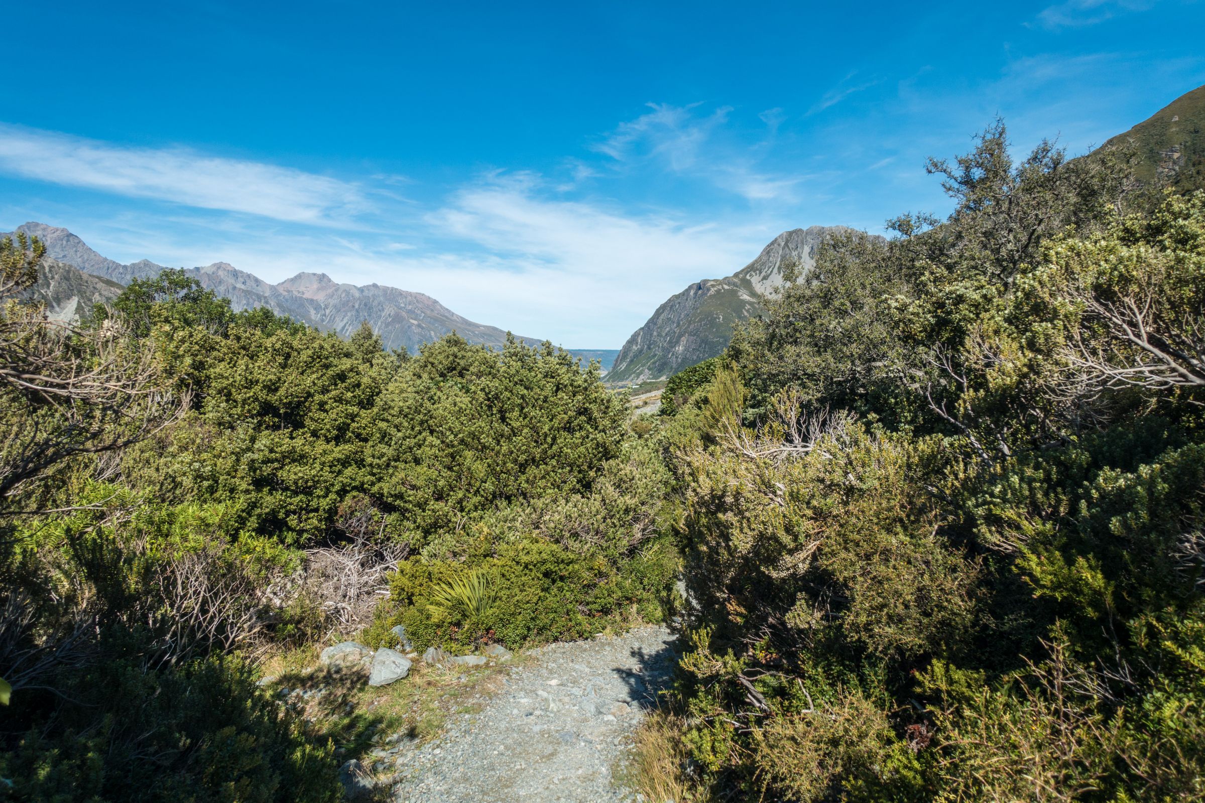
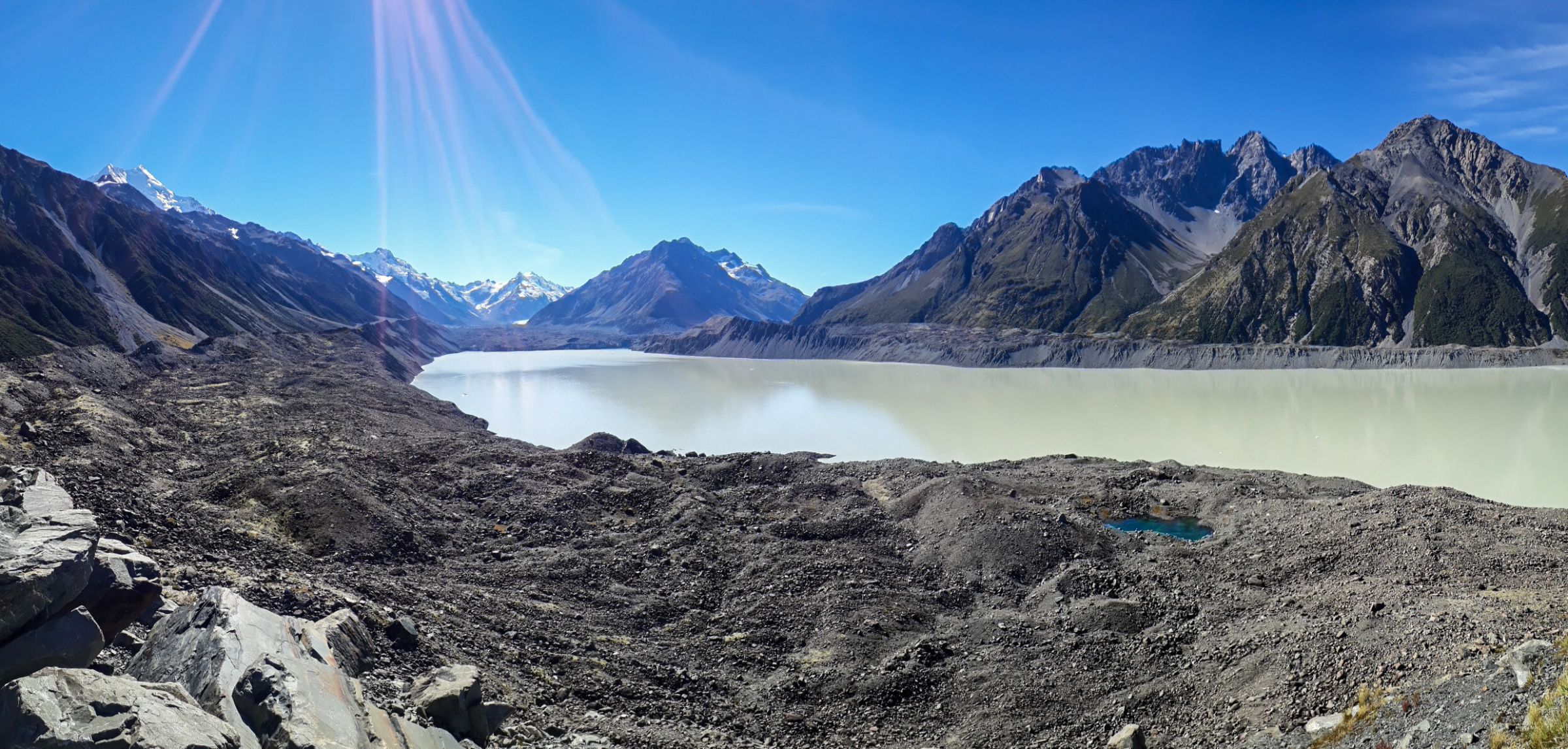
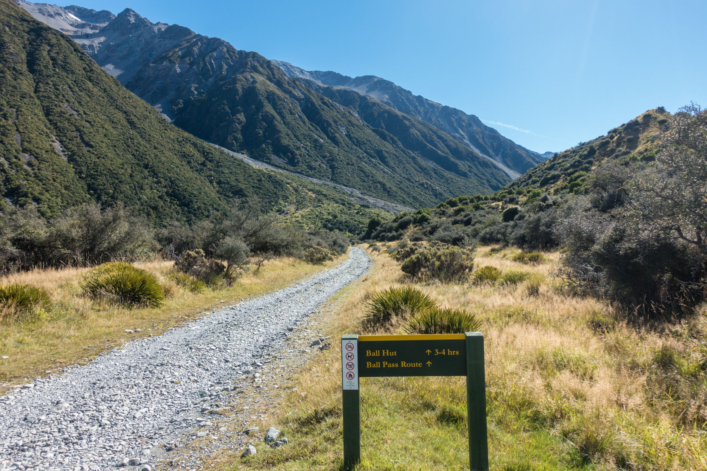
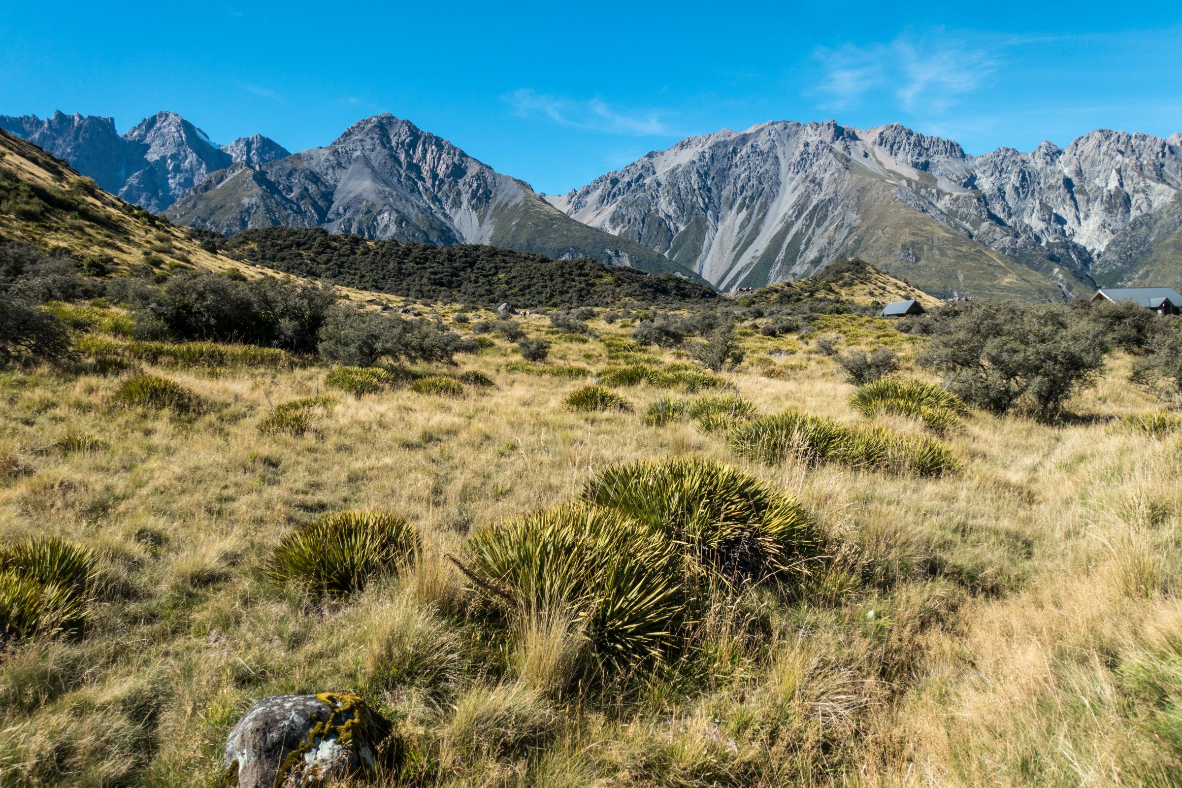
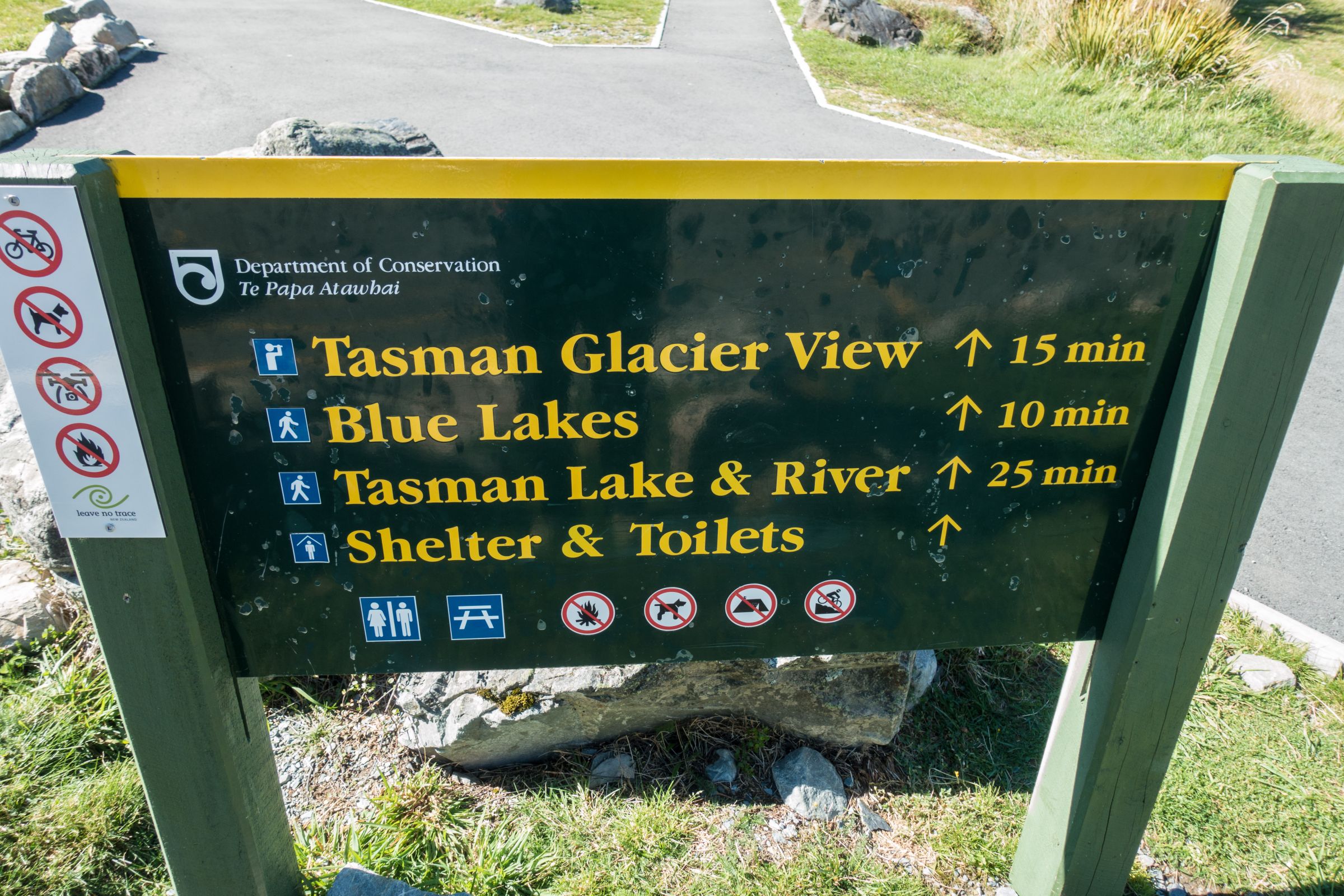
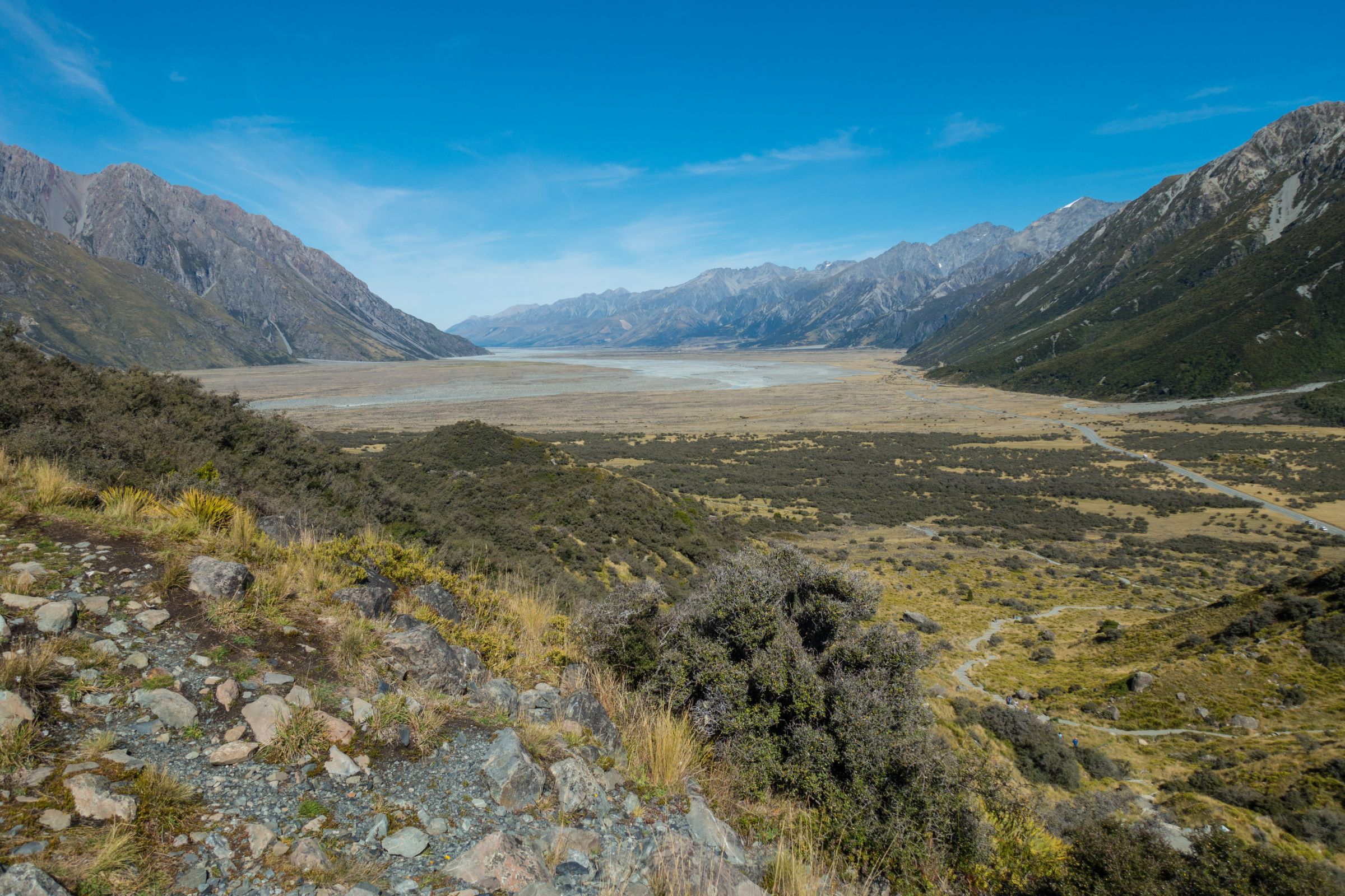
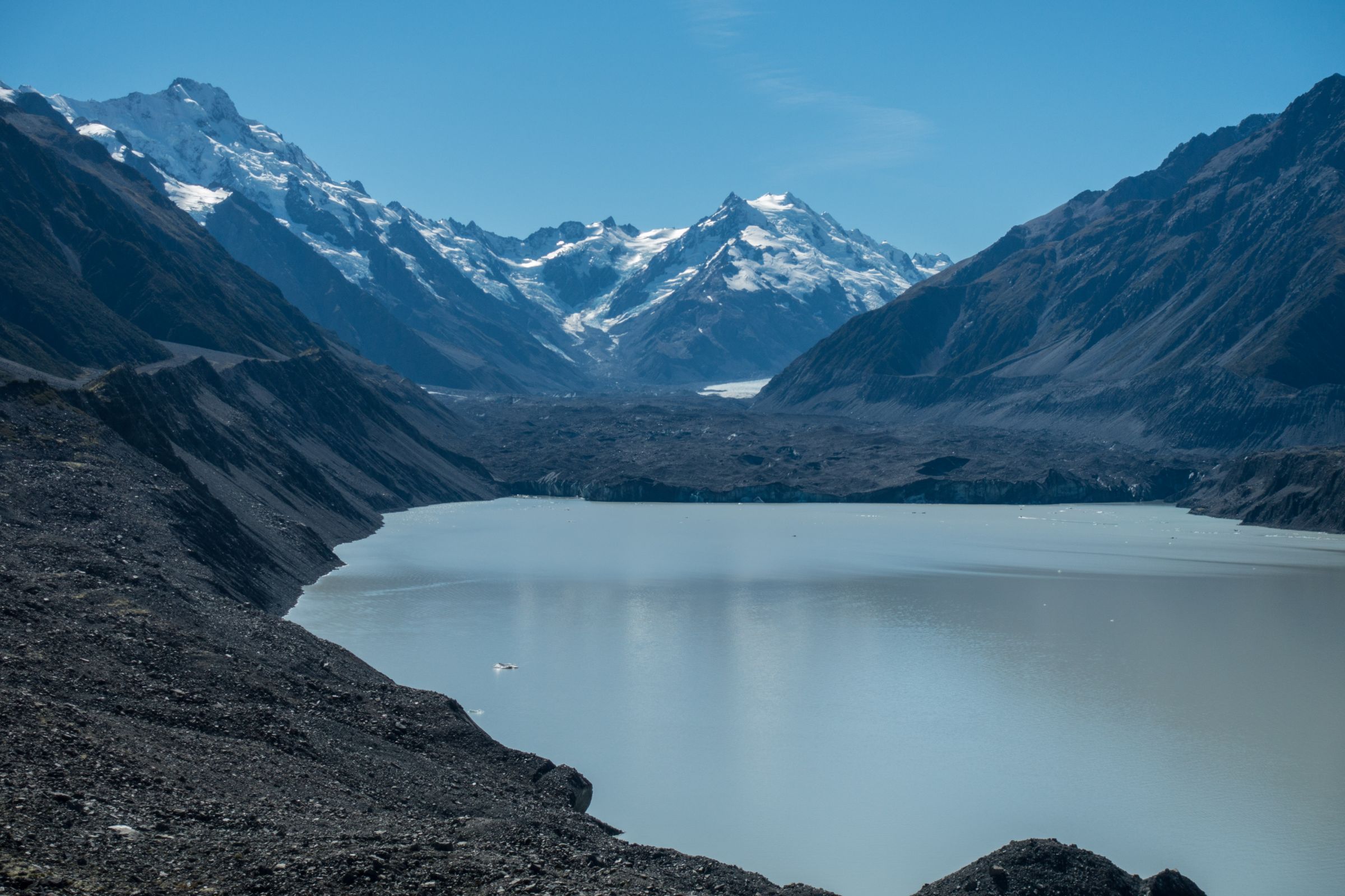
Tasman Glacier Track
Parking and Trailhead: Blue Lakes - Tasman Lake
The trail leads around the Blue Lakes and left of Tasman Lake. Due to a landslip, the trail became a bit longer, 10.2 km, until Ball Hut and the same way back. Depending on the season, icebergs swim in the lake. You get shown how long the glacier was and how fast it is shrinking. It'll take the entire day if you plan to hike to Ball Hut and back. Locus Map Trail
It is a flat walk to the Blue Lakes and back, which takes roughly half an hour. Already from here, the view is spectacular. The Blue Lakes close to the car park are no longer blue. They are green nowadays because turquoise glacier water no longer feeds the lakes. Rainwater supports green algae. Locus Map Trail
The weather can change quickly. Therefore, here is some advice for hiking one of the day trails.
Weather: First of all, check the weather forecast or have a quick look at the information centre.
Hiking Fitness: Know your limits and choose your hikes wisely.
Shoes: Wear proper hiking shoes, at least trainers, for easy hikes.
Head: Protection for your head during summer and winter.
Warm Clothing: Pack additional warm clothes and a waterproof jacket in your backpack.
Sun Protection: Sunscreen and sunglasses are necessary throughout the year.
Insect Protection: Insect repellent but only during the short summer.
Water and Snacks: Plenty of food and water; avoid dehydration. Don’t hike without it! (You think this advice isn’t necessary, but unfortunately, we often see people hiking without anything for hours)
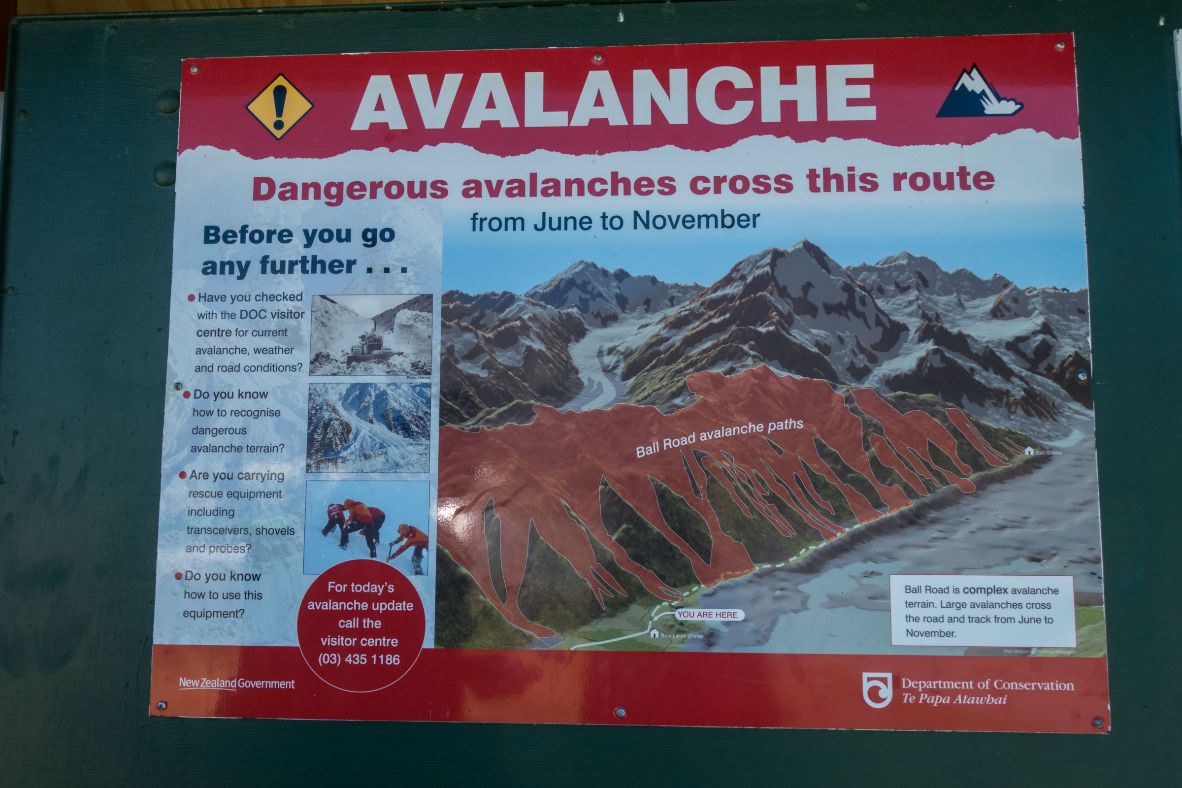
Be Careful and consider carrying a beacon: Depending on your chosen track, you may walk over snow and ice. Avalanches occur along some trails, usually in winter and spring, especially along the Ball Hut and Mueller Hut Route. There was a rescue on November 21 on the summit ridge of Aoraki - Mount Cook. The hikers carried a personal locator beacon in the backpack, so they were easily found. It may have saved their lives.
Weather and Crowds Mount Cook
Rain and snow can occur throughout the year; however, the summer is the sunniest time. The weather is changing quickly in the South Alps of NZ. So, even if the forecast is excellent, be prepared for strong winds, rain, and snow. The mentioned temps for each season are for Mount Cook Village on 760 m elevations. Weather Forecast Mount Cook Village
Spring (September - November)
The suspension bridge on the Hooker Valley Track
In spring, the Mount Cook Village can still experience minus degrees at night and day temps are pleasant on average, between 15-18°C degrees. Nowadays, with climate change, temps in the high 20 can occur. Rain is increasing; showers are likely to happen, but it doesn’t mean it’s raining all day.
Summer (December-February)
December and January are the wettest and warmest months of the year. Rain is already decreasing in February. During summer, day temps are, on average, around 20°C degrees. On a clear and sunny day, temps can climb up to 35°C. Night temps are, on average, around 10°C. Summer is the busiest time of the year. The limited accommodation options are usually fully booked far in advance.
Autumn (March-May)
The summit of Mount Cook is always covered in snow.
There is less precipitation during autumn. March is still pleasant, with day temps around 20°C on average. It gets colder in April and May with day temps around 15°C, but one-digit temps can also occur. Nights are cold, and minus degrees can happen. It’s a little quieter already and again packed with tourists during Easter. We spent three nights here on Easter and experienced all-weather, blue, sunny skies, rain, snow, and hail on the day we left.
Winter (June - August)
It’s chilly here during winter, on average 10°C and colder, however, 20 °C can happen, but that’s rare to experience. Nights are pretty cold, especially if you plan to camp. Expect minus degrees during the night. Winter is a little drier than the summer months. Some huts and trails on higher elevations may be closed, but the most popular ones are less busy.
Hooker Valley Track - Update
Hooker Valley Track is reopened but closed during poor weather conditions because heavy rain caused erosion at the river banks and the second swing bridge along this trail.
Accommodations and Camping in the Aoraki – Mount Cook N. P.
Mount Cook village is easy to reach, but there is just one long road, the State Hwy 80, leading along Lake Pukaki to the village and out. It is quite a journey if you don’t stay in the village. You need at least three hours from Queenstown and four from Christchurch.
The hotels and village are located to the right.
There are very few accommodations, so advanced booking is utterly necessary throughout the year. Lodges, Chalet, and Motel for Aoraki (Bookmark the Link for price guarantee at booking.com). Stay at least 3 better 4 days in case of poor weather.
Our lunch after our arrival - Mount Sefton in the back.
The weather can change very quickly here in the NZ Alps. We experienced sunny blue skies, rain, hail, and snow on our last day.
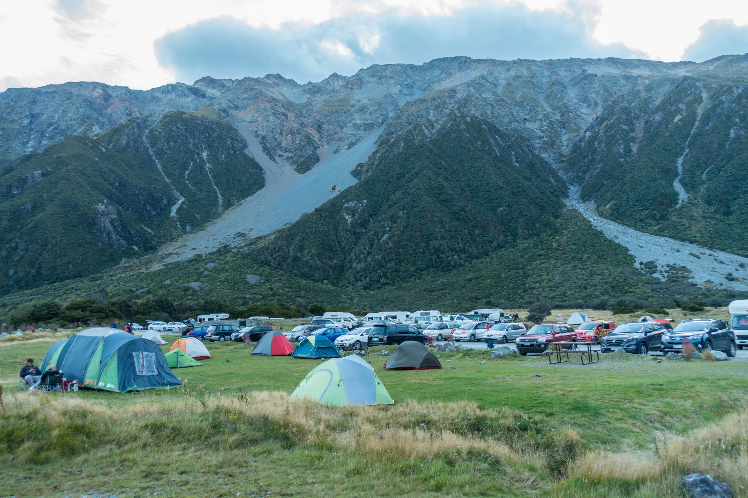
Usually, you always get a place to pitch your tent.
The doc campground is enormous - 60 non-powered sites. You can pitch your tent wherever you want. It's first come, first serve. One public shelter for cooking is relatively small during rain or hail in the peak season. Hot showers are only in the village available.
This guy was tough sleeping under a tarp in April.
However, nights are cold; temps can drop below zero. I know what I am talking about. Bookings are required throughout the year. Tent site booking
Is it Worth Visiting Mount Cook?
I, on the Sealy Tarns Hiking Trail, enjoyed the breathtaking scenery.
In my opinion, it’s a Must-Do. Honestly, a camera cannot capture all the spectacular views and the stunning landscape. I recommend visiting Aoraki at least on a day trip. Start as early as possible and stay until sunset. There is one very well-organized day tour from Christchurch. It is a long journey, but there is so much to see on the way to Aoraki. The most stunning months for this guided tour in a small group are November to January when the picturesque lupin fields at Lake Tekapo are in full bloom. This is such magical scenery on the South Island. Another stop is the famous Church of the Good Shepherd.
These are my recommended tours via GetYourGuide with 24-hour advance cancellation policy. Thx for booking via my website! With your support, I am able to provide all the information first-hand. Tour prices are at no extra cost!
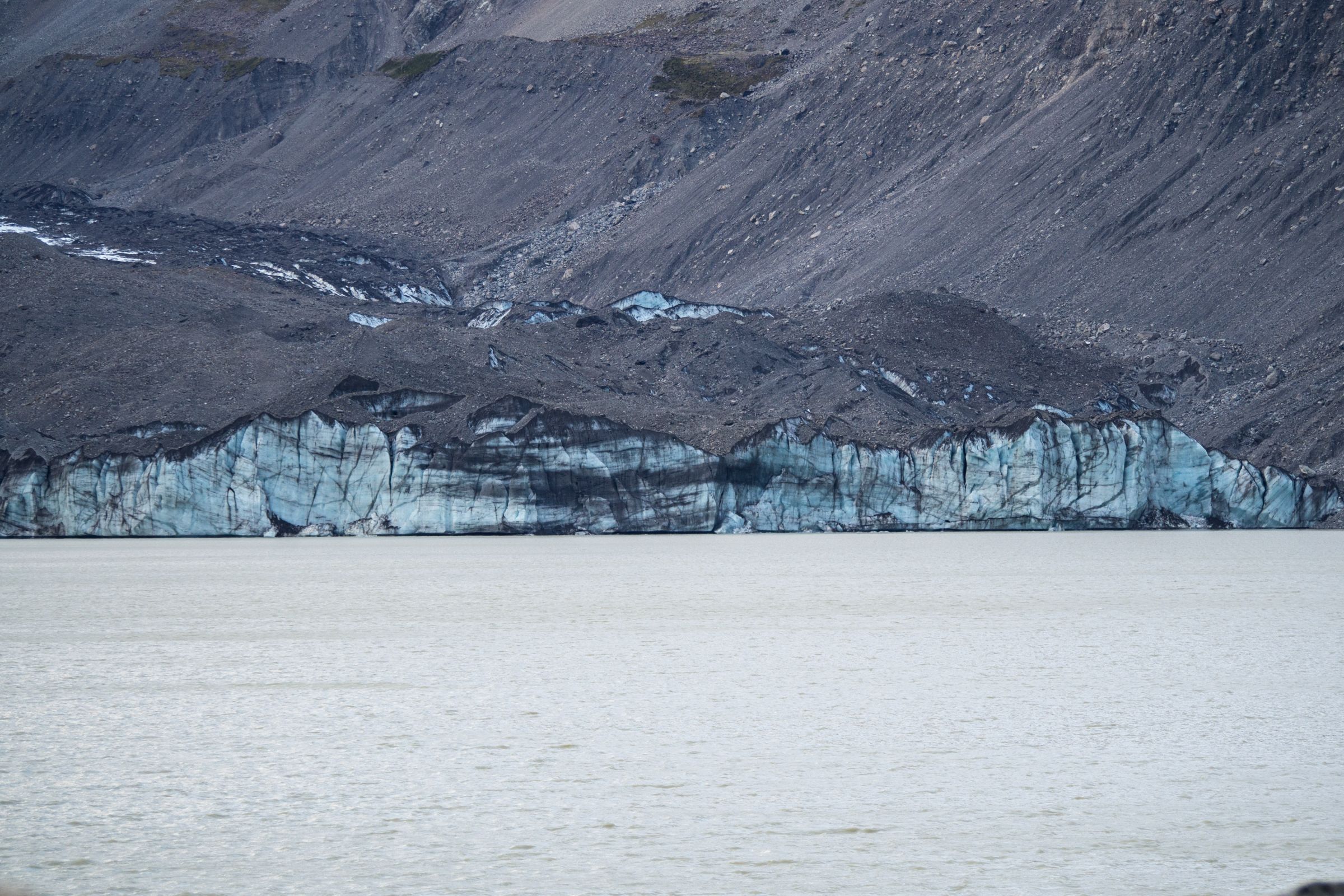
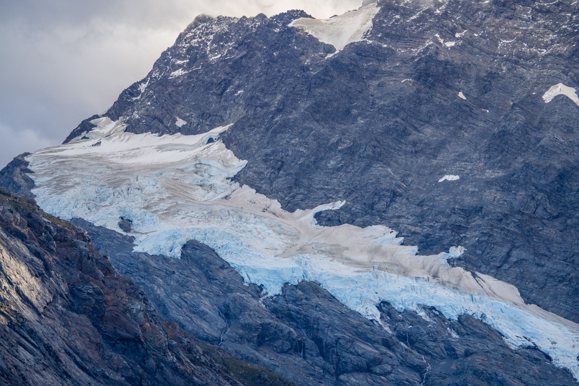
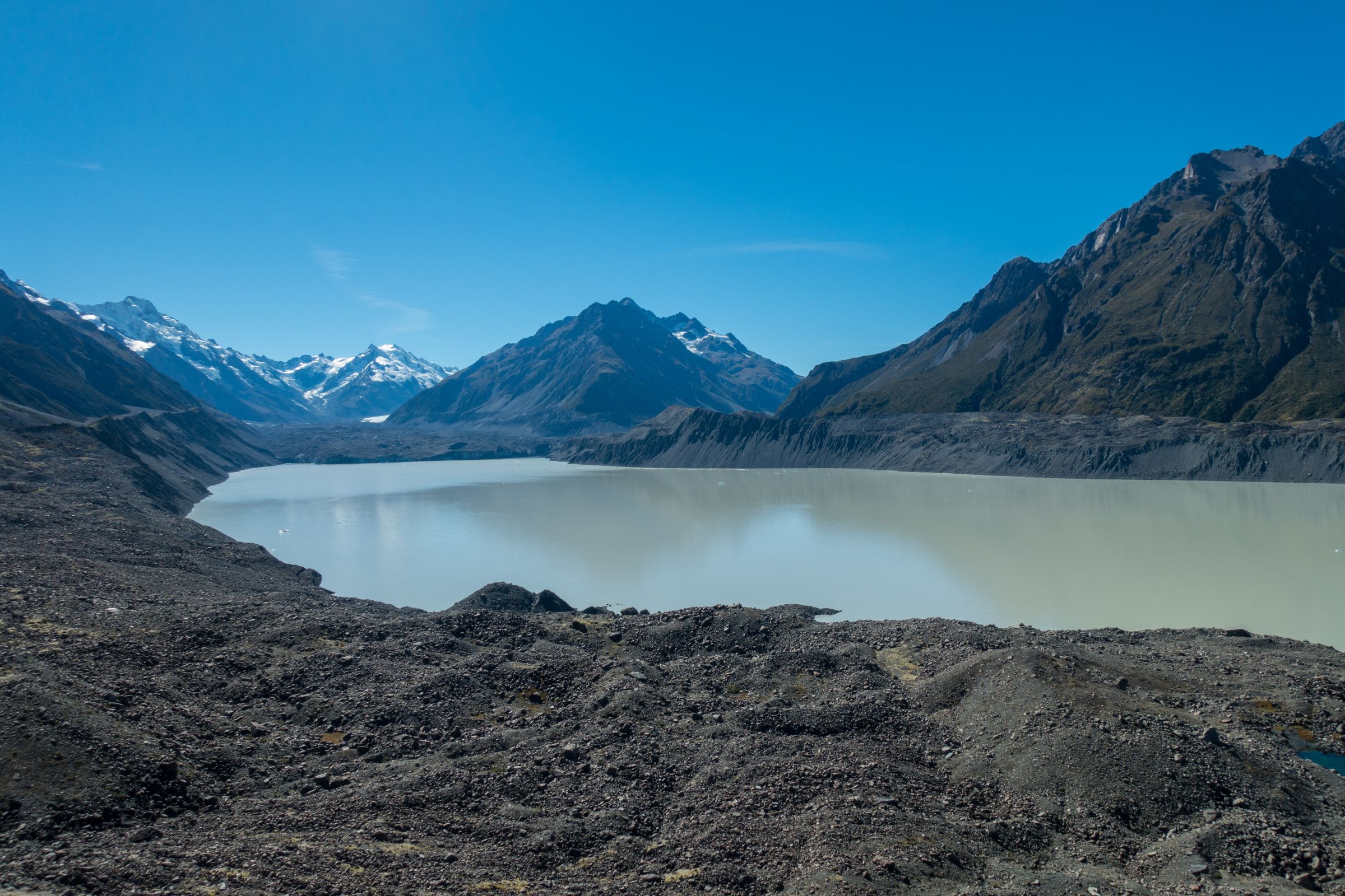
The most exceptional tour is the 3-hour heli hike to the Tasman Glacier. You will love the fantastic view of the surrounding snow-capped mountains and the hike on the glacier for 2 hours. No worries, renting gear like boots, crampons, and a waterproof jacket are included. Do you want to experience a glacier? Do it as long as it is possible. The Tasman Glacier's retreat from the early '70s to today is more than 7 km. This tour is less busy than Franz Josef Glacier. More facts about the Tasman Glacier are at the end of the article.
The glacier is far in the distance nowadays.
If you don't want to hike on a glacier, enjoy a 25-minute scenic heli flight with spectacular views of Mount Cook - Aoraki, which you will never forget. Included is an alpine landing with a direct view of Aoraki.
The more than 700 km2 big National Park is a hikers' and photographers' dream. You get blown away by this beautiful scenery. Even if it is busy here, start hiking and escape the crowds. The area was already declared a National Park in 1953. According to the legend of the Maori, Mount Cook and the surrounding peaks emerged when a boy named Aoraki and his three brothers took a canoe to ride from heaven to Mother Earth.
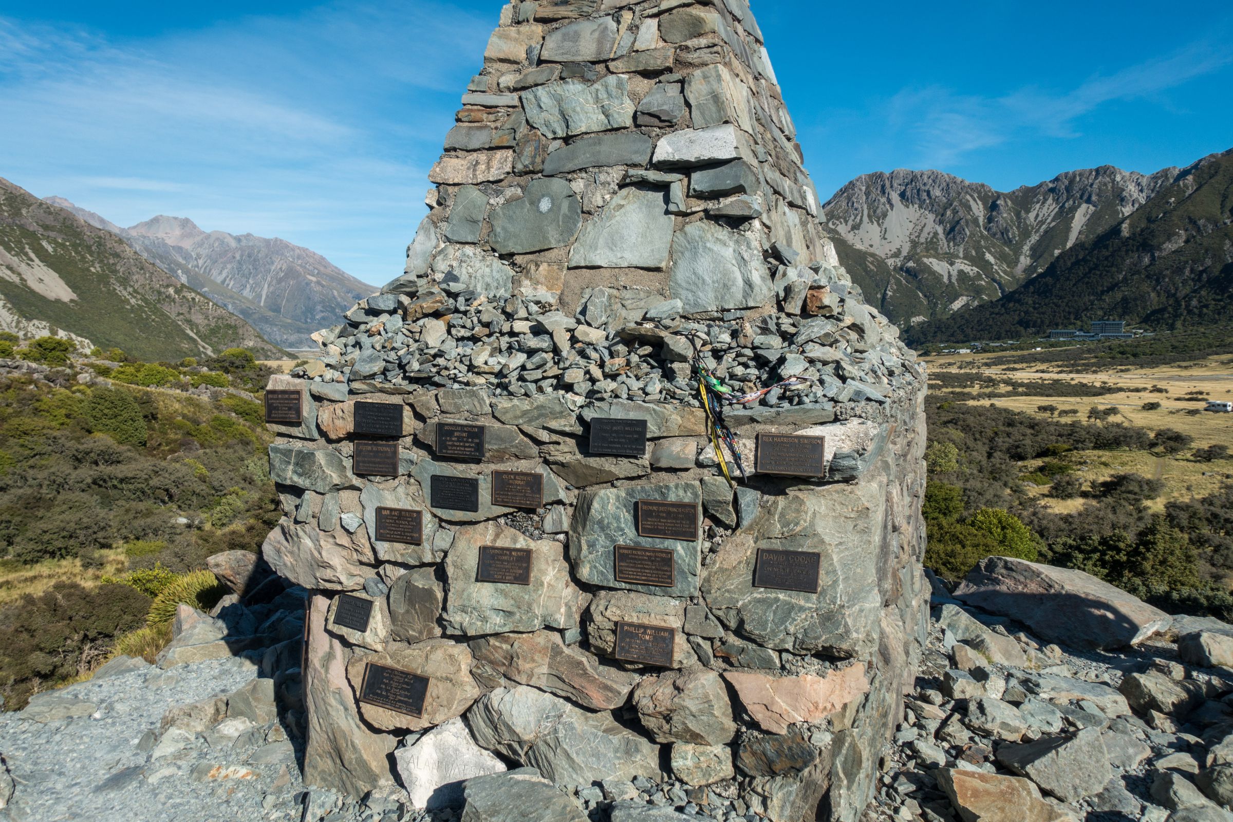
Alpine Memorial for those who perished in this National Park.
The canoe capsized, and while the boys climbed on the back of the boat, they turned into stone. There are many things to do in the Aoraki National Park. The most popular activities are hiking, helicopter scenic flights and hikes, and guided kayak tours on Tasman Lake. And don't miss the exhibition in the Information Centre.
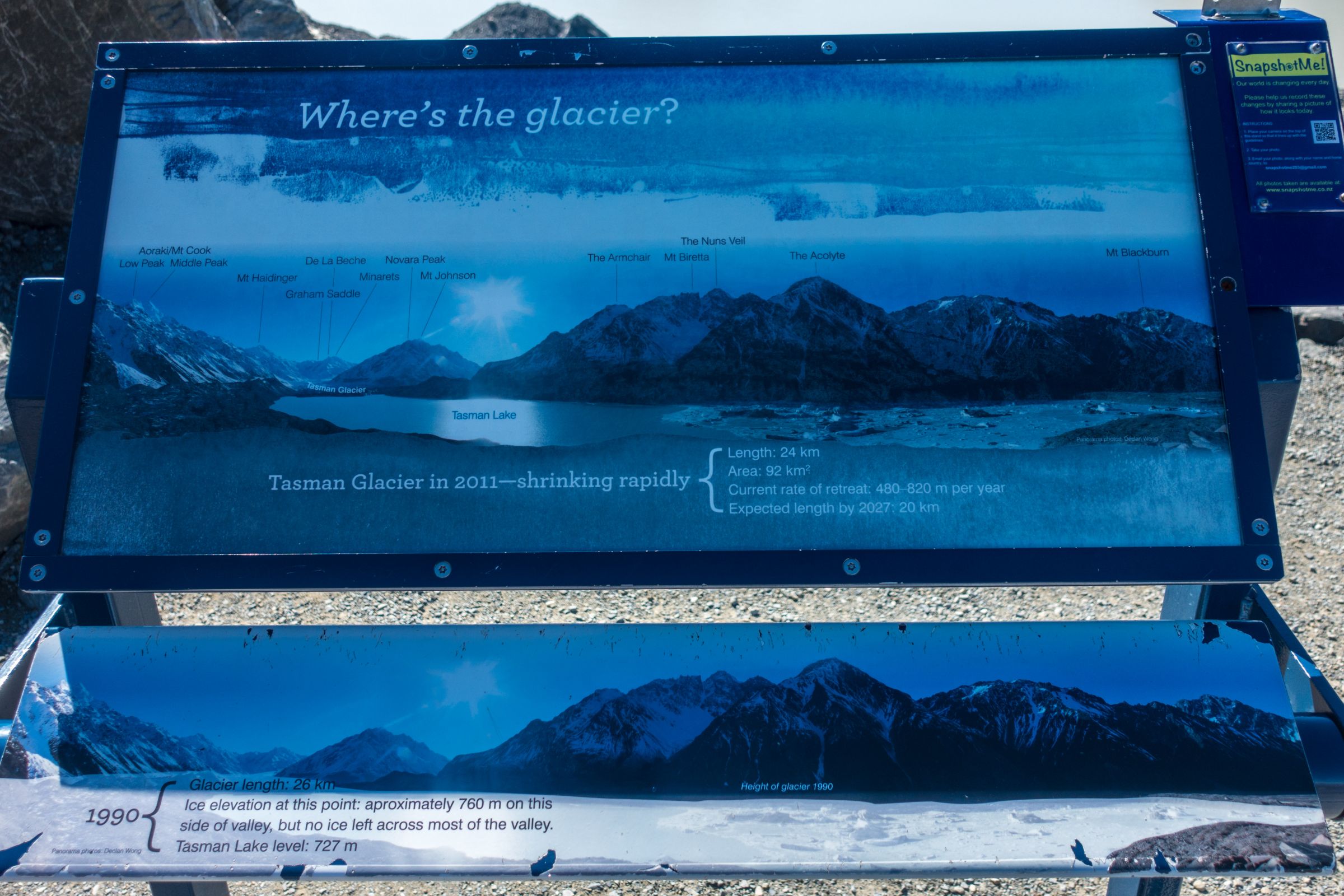
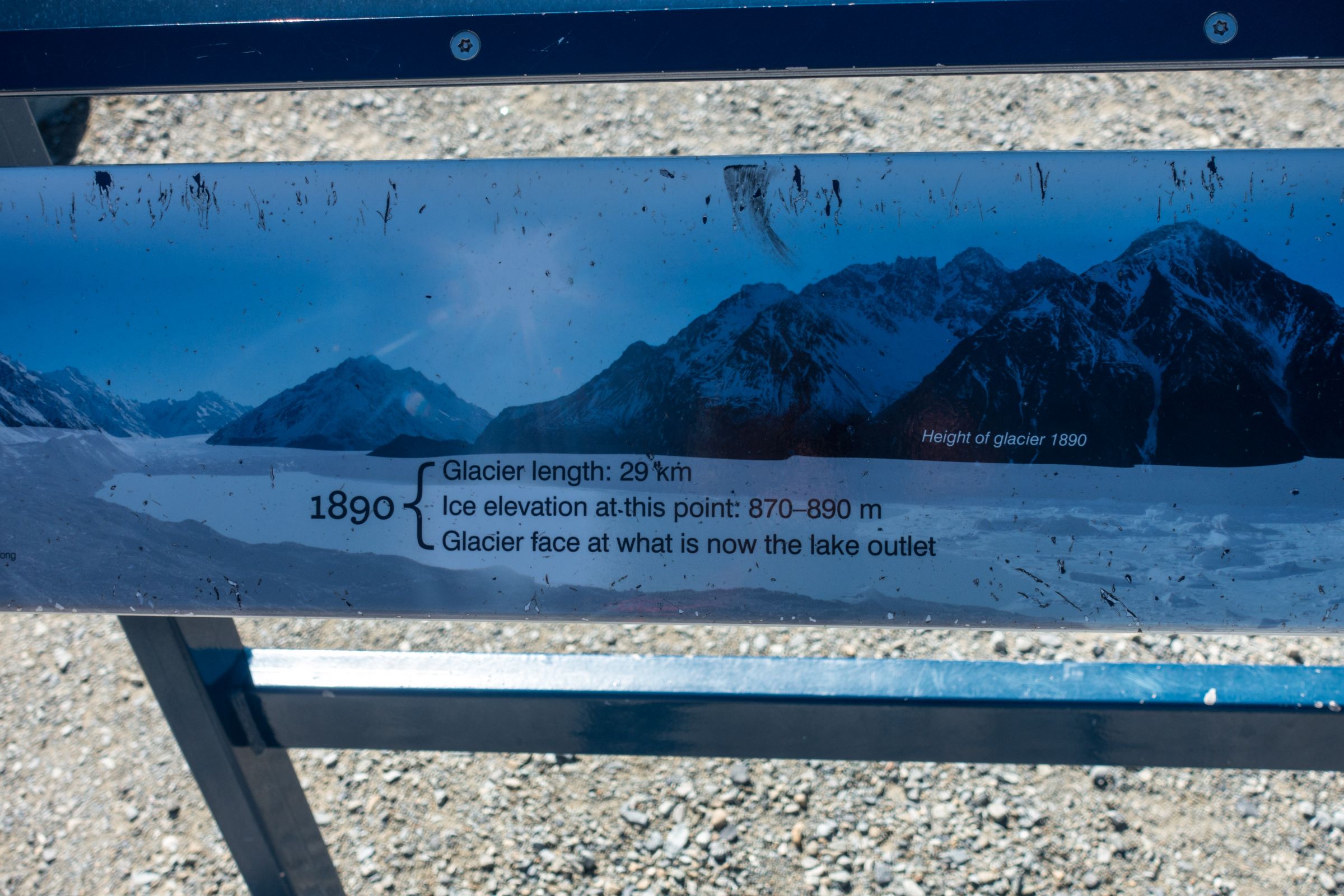
Quick Facts About Tasman Glacier
It’s the largest glacier in New Zealand – twice the size of the Franz Josef Glacier
Starting on an elevation of 3000 m
Glacier length roughly 14.500 years ago 85 km
1990 = 26 km
2011 = 24 km
Length nowadays roughly 23 km
The glacier is shrinking fast; its estimated length by 2027 is only 20 km
Tasman Glacier has been monitored since the early 1970s, with an estimated retreat unbelievable of more than 7 km
Chunks of ice which are calving off are always getting more significant. In February 2019 one of the biggest events happened so far.
Global warming is real!!
To plan your trip or explore the Islands, we recommend the guidebook from Fodor’s. It is packed with maps, carefully curated recommendations and everything else you need to simplify your trip-planning process and maximise your time onsite.